Blog Archive

Showing posts with label Flickr. Show all posts

Tuesday, November 15, 2011

Stuck on Earth? What a Nice Place to Be


Flickr maps are probably one of the most overdone types of Google Maps mashup. Therefore I very rarely post them on Google Maps Mania any more. Stuck on Earth, however, is a thing of great beauty and deserves an honourable mention.

Stuck on You is an iPad travel guide application. The app itself works on the simple premise that most users of travel guides mostly look at the photographs and think 'I want to go there". The app therefore allows the user to explore the world through beautiful photography.

Stuck On Earth uses photography shared on Flickr. You can follow individual photographers that you like via the app and you can even submit your own photographs. Whilst browsing the app you can create individual trips based on your favourite locations and all saved trips can be accessed even when offline.

Via: TNW

Thursday, August 4, 2011

Create a Real-Time Flickr Google Map


.net magazine has published a great tutorial on how to create a real-time animated Flickr map. The tutorial was written by James Christian and Ben Gannaway the creators of the excellent Net-a-Porter Live Google Map.

The tutorial explains how to create a Google Map that animates in near real-time through images posted on Flickr. The tutorial includes how to work with the Flickr API and how to customise the look of your map.

Alongside the tutorial is a demo map and a link to download the full source code.

Integrate Google Maps and Flickr into a Real-Time App

________________

Sunday, June 6, 2010

The Elephant Parade on Google Maps

The Elephant Parade

It's not often I get the chance to post a map showing the location of 250 elephants.

In London, a conservation campaign called Elephant Parade from www.elephantfamily.org, has enlisted 250 artists and celebrities to decorate 250 elephants and then place them all around the city. The aim of the campaign it to help raise awareness of the plight of the Asian elephant.

The murphyzVille blog has gone all big game hunter and has managed to track down the location of all 250 elephants, captured the elephant's digital image and posted the geo-tagged photograph on this Google My Map.

If you want, you can also view the photographs without the map in this Flickr set.

________________

Saturday, May 22, 2010

Flickr Time-Line Google Map

Flickr Time Photolayer

This is an interesting mashup of Google Maps and Flickr using the SIMILE Widgets Timeline component.

The map allows the user to view Flickr images for any location in the world. If you don't like the latest photographs for your location then you can use the time-line above the map to view Flickr photographs uploaded on different dates.

This addition of the time-line means that you can search for photographs for particular locations on specific dates, such as Washington on the day of President Obama's inauguration or Greenwich Park on the day of the London Marathon.

________________

Wednesday, November 11, 2009

Historical Photos & Street View Mashup

Then & Now

Then & Now is another entry from the MashupAustralia contest. The map is a mashup of historical photographs from Flickr and Google Maps Street View. In essence the site places historical photographs on Google Maps and shows the same location as it is now via Google's Street View imagery.

Unfortunately there are a lot of false results produced and many of the photographs end up with a 'Sorry, there is no streetview available for this location' message. However, the occasions when it does work, more than make up for the disappointment when it doesn't.

Via: @geoparadigm


I'm a great fan of these historical Google Maps mashups. Here are few of my favourite maps in a similar vein:

Tate Gallery Mapplet

The Tate have used Street View to help explore locations depicted in a special selection of their artworks. The mapplet tries to show the same view as depicted in the paintings. Part of the idea behind the mapplet is to explore how urban and rural environments have changed.

LookBackMaps

LookBackMaps is a collection of historical photographs that can be compared to the same current view as seen on Google Maps Street View.

The photographs are geotagged and displayed on a Google Map. Users of the map can select a date range for the photographs that they wish to view. To view a photograph alongside the current Street View just click on any of the pictures inside the information windows.

To add your own historical photographs to the map you just need to register with LookBackMaps.

Utrecht van Boven - historical photos of Utrecht on a Google Map
Sydney Sidetracks - a map of audio, video and photographic records of Sydney's past
HistoGrafica - historical photographs on Google Maps
Virtual Time Travel - archive film of locations. One of my own old mashups. Some of the videos may now have been removed from YouTube but there are still enough old films here to make it worth a visit.

________________

Thursday, October 1, 2009

Create Your Own Flickr Google Map

MapFlickr

MapFlickr is a new map creation site that lets you create a Google Map to display your Flickr photoset.

Creating a map is very simple. You just select the required Flickr photoset and press create. That is essentially all you have to do. Your map is then created and you can then cut and paste a short piece of code to embed the map in your own website or blog.

MapFlickr also allows you to style the colour of your map border, the photo gallery buttons and the photo border colours. It is also possible to customise the size of your map, the number of photos you wish to display, the size of the photos and the type of map marker.

_____________

Saturday, September 26, 2009

New Photo Markers in ACME Mapper

ACME Mapper

Jef Poskanzer's ACME Mapper provides additional mapping layers and functionality to Google Maps that are not currently available in the standard Google Maps interface (as well as some that are):
  • Topo and DOQ mapping layers (from TerraServer's Web Services)
  • Map scale that automatically adjusts as you zoom out
  • A "crosshairs" widget that shows you exactly where you are centered
  • Print, Email, 'Link to this page' functions
  • A box showing exact coordinates of the center of the map, in your preferred format
  • Nearby placenames from where the map is currently centered
Jef has now added Flickr and Panoramio photographs to the map. To view the Flickr and Panoramio photos on the map click on 'options' and select the correct checkboxes.

_____________

Monday, September 21, 2009

Twitter & Flickr Google Map

GeoImpress

GeoImpress let's you search for Flickr photographs and Tweets from any location in the world. This is a very crowded market to enter. There have been more Google Map mashups that use Flickr than any other website, with Twitter mashups catching up fast.

However GeoImpress does indeed impress, thanks to its wonderful design. Flickr photographs are shown below the map in an animated slide panel that can be lowered or raised as you need to use the map. Clicking on a photo thumbnail will open that picture in a lightbox.

Another really nice feature is the precision slidebar that lets the user define how close to the set location they wish to search. So, for example, if you set the location to Times Square you can get the map to display photos and Tweets from Times Square, or widen the search to get results from the outlying district or widen out further to include the whole city or state.

Yep, I'm impressed.

_____________

Sunday, September 13, 2009

Google Map of Nearly Everything

iHaochi

iHaochi is a Google Map that let's you explore geotagged content from a large number of websites, including BrightKite, Flickr, Panoramio, Picasa, Upcoming, Wikimedia Commons, Wikipedia, and YouTube. The map also features "Local News" and "Local Tweets", showing news from Google News and recent tweets from Twitter.

The map even has a "Local Friends" option that lets you connect with Facebook and then shows you how many Facebook friends you have in each U.S. state. The map loads all this geotagged content dynamically. Therefore if you navigate around in the map the map markers will update automatically.

_____________

Saturday, June 20, 2009

Photosynth on Google Maps

Photosynth Map

I'm a big fan of Microsoft's Photosynth. I therefore decided to create this Google Map to highlight some of my favourite Photosynths. The map geotags a number of Photosynths of famous landmarks around the world.

Use the right hand sidebar links to zoom in on a Photosynth and click on the white round map markers to open the Photosynth embedded within the Google Maps' information window.

MyPicsMap

MyPicsMap is a cool application for viewing Flickr photos on a map. You can view photos of a Flickr user by entering their username or just explore the world through location.

If you click the 'explore' button from the opening screen it is then possible to zoom in on any location. When you pan or zoom the map thumbnails of Flickr photographs are loaded on the fly. The map also comes with a search function, so it is possible to search for your favourite locations.

If you click on a thumbnail the photograph opens in a lightbox directly above the map.

_________________

Sunday, April 19, 2009

I Want to Teach the World to Sing

SingTheWorld

SingTheWorld is a Google Maps jukebox and photo viewer. When the map first loads the user is asked to click on a tag. SingTheWorld then plays a song related to the tag and animates through photographs from Flickr with the same tag.

Once the animation begins you can, as the map says, "Just relax and let the music free your mind." If the music and the photographs fail to free your mind then you can choose from other tags that appear beneath each Flickr picture.

_________________

Monday, March 2, 2009

Flickr Timeline Map

Flickr Map

According to Programmable Web after Google Maps, Flickr is the most mashed-up service on the web. With all the Flickr maps out there it is quite difficult to come up with something new or different to justify yet another map of people's photographs. Luckily Flickr Map has come up with a fresh approach that adds a really useful feature.

Flickr Map uses the Simile Timeline with Flickr and Google Maps to create a searchable map of Flickr photographs. Adding the Simile timeline means that users can search the map for photographs by tag and also by time. So, for example, it is possible to compare photos taken in New York in January with those taken in July.

Also See
_____________

Thursday, January 1, 2009

New Years Photos on Google Maps

What? Where? When?

What? Where? When? is a new Google Map mashup that uses the Flickr API to show where in the world photos have been taken. It possible to search for photos with a particular tag and areas with photographs matching that tag will be shown on the map by a yellow circle. The size of the circle at any given place indicates how many photos were taken there.

You can click on a circle to see photos taken in that area, or zoom in if there are lots of overlapping areas. The photgraphs are shown film strip style along the bottom of the screen.

Via: Read Write Web

Tickr

What? Where? When? is a similar idea to Tickr that Google Maps Mania reviewed last year. In essence Tickr lets you search Flickr by keyword and location. It is therefore possible to search Flickr for 'architecture' in 'Rome' or 'glaciers' in 'Alaska'. Or if you want to see how the world celebrated last night search for New Years Eve photos in different countries.

________________

Monday, August 11, 2008

Dipity

Dipity
Dipity allows users to easily create timelines on any subject. The created timelines can then be embedded in a website or blog. That in itself would be a reason for great cheer but Dipity also allows users to geo-tag the events on a Google Map. It is therefore possible to show the progress of a subject both chronologically and geographically. For example, you could show the progress of the Lewis and Clark expedition in a timeline and on a Google Map.

That's not all, Dipity have also accessed the API's of Flickr, YouTube, Digg and a number of news sources to allow you to create mapped timelines of photos, videos, Digg posts and news stories.
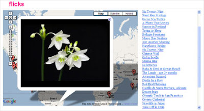
Tickr
Tickr allows you to build a timeline of Flickr photos for a particular tag. Users can use the timeline to see when and where images for a given keyword, tag or Flickr user were taken.

Here are some geo-tagged Flickr photos of last weekend's Red Bull Air Race in London:

screenshot of Dipity embed

TimeTube
TimeTube allows you to build a timeline of Youtube videos for a particular tag. Here is a TimeTube of Google Maps related videos:


Newsline allows you to build a mapped timeline of a particular news story and Archaeologist lets you build a timeline of Digg posts for a particular keyword.

Simile
Simile is another timeline builder that it is possible to combine with Google Maps. The Google Maps team created this comprehensive Google Maps Mania timeline showing all the posts over the years from this blog. It is an amazing example of what can be created using Simile with Google Maps.

To use Simile with Google Maps you will need a working knowledge of the Google Maps API. Dipity on the otherhand requires no development knowledge. So, if you want to map a timeline, choose Dipity for simplicty and choose Simile if you want more control over the design and features.

_________________

Thursday, June 12, 2008

Photo Search on Google Maps

Tickr

Sometimes the best ideas are also the simplest ones. Tickr is a simple idea but also a great one. In essence Tickr lets you search Flickr by keyword and location.

Why is that so great? Well, it means you can make some great visual comparisons of different cultures around the world. For example, the images in this post show some of the differences in fashion in California and Japan. I've just spent at least one happy hour comparing 'houses', 'pubs' and 'businessmen' in different countries.

The examples on the Tickr homepage include 'architecture' in 'Rome' and also 'glaciers' in 'Alaska'. The latter example is a good demonstration of another feature of Tickr - the time-line. As well as showing the location of photos on a Google Map, Tickr also presents the photos in a time-line based on when the photographs were taken. This means that in the given example it is possible to compare photographs of glaciers taken in 2001 to photographs taken this year.


Other Flickr Maps
__________

Monday, April 14, 2008

Flickr Google Maps

Last week Flickr started hosting videos as well as photographs. Flickr hopes to differentiate itself from other video hosting sites, like YouTube, by only allowing short 90 second videos which they hope will generate “long photos,” or "slices of life".

Flicks


Flicks is the first Google Map site to take advantage of Flickr's hosted videos. The site is a selection of Flickr videos tagged on a Google Map. Flickr users can geotag their videos when they are uploaded to their account and Flicks uses these geotags to embed the videos on a Google Map in the exact position that they were shot.

Having a browse through the videos on Flicks, it soon becomes obvious that Flickr have succeeded in producing something different from YouTube. The video player is far more attractive and so far the quality of the videos submitted by users are of a much higher quality.

Trippermap


Trippermap is a web site that allows you to put a Google Map of your Flickr photos on your own web site or blog. If you haven't got a web site or blog it doesn't matter because Trippermap will host your map for you.

Trippermap supports photos that have been geotagged and will even map your photos if they are tagged with a city or country name. The Google Map has an easy to use interface. The photos are clearly tagged on the map and small thumbnails are placed in a strip along the bottom of the map to ease navigation of your photo set.

Other Flickr Maps

flickrvision
loc.alize.us
fotoland

__________

Popular Posts