Google have today announced that companies can pay to place their logo on Google Maps. Only they didn't quite announce it like that.
The Official Google Australia Blog claims that the move is designed to help you navigate Google Maps,
"These easily recognisable logos more closely depict online what the offline world looks like, so next time you're trying to find your way on the map you can navigate more easily using these icons as landmarks."
However, the main purpose of these logos is obviously not to be a navigational aide. If the aim was to improve navigation then businesses wouldn't need to cough up some cash to have their logos appear on Google Maps.
I have no problems with Google using Google Maps as an interactive billboard. Certainly a lot of businesses will benefit by having the locations of their outlets be more easily seen on Google Maps (conversely businesses that can't afford to advertise on Google Maps may suffer).
Just don't try to claim the move is designed to be a navigational aide.
I'd be interested to hear what regular users of Google Maps think of this move. Please give your feedback via the comments below.
Via: Official Google Australia Blog
_____________
Blog Archive
-
▼
2012
(463)
-
▼
June
(79)
- It's Time for Google Maps
- Google Maps API Gets Heat Maps
- Animated Symbols on Google Maps
- Google Maps Symbols Take Off
- Exciting New Features for the Maps API
- Offline Google Maps for Android
- London 2012 - Transforming the Lea Valley
- Guild Wars 2 on Google Maps
- Egyptian Real Estate on Google Maps
- I/O, I/O - It's Off to Google we Go
- Plane Crash Sites on Google Maps
- We Want New Street View
- Social Search with Google Maps
- Google Lego Maps
- Introducing the ikiMap API
- Trulia's New Commute Time Maps
- A Travel Journal with Google Maps
- Google Maps for those Ready to Rock
- The Google Maps of the Week
- University of Florida Live Bus Tracking
- The Tour de France on Google Maps
- Lower Prices for the Google Maps API
- Carousels & Ferris Wheels on Google Maps
- Languages at Risk on Google Maps
- Some Apple Maps Friday Fun
- Geographic Micro-Blogging with Google Maps
- When Zombies Attack on Street View
- Fly Down Your Street with Street View
- The Transat Québec Saint-Malo Tracking Map
- Google Maps Gets More Traffic
- The Philippines Flood Hazard Map
- Hawaii on Street View
- A Trip Planner with Weather Forecasts
- Drilling Water Wells with Google Maps
- The London Bloggers Tube Map
- Park a Jeep with Google Street View
- The World of Warcraft Google Map
- Make a Roadtrip Mixtape with Google Maps
- Nature Spotting with Google Maps
- French Elections on Google Maps
- The Google Maps of the Week
- The Pathfinder World on Google Maps
- Helping Haiti with Google Maps
- Naked Monkey Hot Tub Fun
- Facebook Checkins with Googla Maps
- 200 British Towns on Google Maps
- Animate GPS Tracks with Google Maps
- A Google Maps City Guide
- Google Maps Sets the Pace
- Carmelo Anthony's Life on Google Maps
- Kenyan Demographics on Google Maps
- Street Musicians of the World
- A Google Map for the New Economy
- Driving Direction with Suggested Stops
- A New Google Maps Creation Tools
- Tracking the Tardis in Space & Time
- An Improved Running GPS Tracker
- The Google Maps of the Week
- The Hip Hop Map Guide to New York
- The European Championships on Street View
- Friday Fun with Google Maps
- View Crime Around You on an iPhone
- The Best Plane Seats with Google Maps
- Surfing the World with Google Maps
- Google Maps - The Next Dimension
- Electric Car Distances on Google Maps
- London Calling on Google Maps
- Mad Men on Google Maps
- Roman Empire Route Planners
- Transit of Venus Maps
- Martian Street View - Part Two
- Detecting Deforestation with Google Maps
- Displaying Road Quality on Google Maps
- The Google Maps of the Week
- Parallax Clouds on Google Maps
- Ambulance Response Times on Google Maps
- Tracking Ice Cream Vans on Google Maps
- Building Bridges with Google Maps
- The Inaugural Data Journalism Awards
-
▼
June
(79)
Showing posts with label Google Maps. Show all posts
Wednesday, March 17, 2010
Friday, February 12, 2010
Google Maps in Google Labs
Google Labs Option on Google Maps

Google have added an option to add a number of Google Labs experiments to Google Maps. The new options include the ability to rotate maps in Google Maps, view the new aerial (oblique) view imagery, play a geography game and more.
To add the new options just click on the 'New' link that should appear at the top of the page (if you are viewing Google Maps whilst logged into a Google Account). Alternatively if you click on the link at the top of this post it should automatically open up the Google Labs options in Google Maps.
Here are the Google Labs experiments that you can now add to Google Maps:
Drag 'n' Zoom
Zooming in on a specific part of the map is now fast and easy. Simply click the Drag 'n' Zoom button, draw a box on the map, and zoom! You're there!
Aerial Imagery
Add Aerial imagery to the map! Aerial imagery gives you rotatable, high-resolution overhead imagery presented in a new perspective. Currently imagery is only available in certain areas, but we're adding more all the time.
Back to Beta
Gmail isn't the only one that can enjoy a BETA tag.
Where in the World Game
Test your knowledge of world geography! Guess the name of the country from satellite imagery, and try to beat your top score!
Rotatable Maps
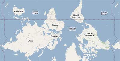
Tired of North always being up? Add rotatable map types and give East, West and South a fair go.
What's Around Here?
Adds a second search button that searches for "*", returning the top results in the current view. A great way to browse the map.
LatLng Tooltip
Displays a tooltip next to the mouse cursor showing the latlng directly underneath it.
LatLng Marker
Adds an option to the context menu that lets you drop a mini marker showing the latlng of the position that the cursor was pointing at when the context menu was evoked.
Smart Zoom
Ever zoom in too far and get the message "We don't have imagery at this zoom level"? Ensure you don't see it again, with Smart Zoom, which will check in advance what imagery exists, and ensure you can't zoom in beyond it.
Via: Blogoscoped
_________________

Google have added an option to add a number of Google Labs experiments to Google Maps. The new options include the ability to rotate maps in Google Maps, view the new aerial (oblique) view imagery, play a geography game and more.
To add the new options just click on the 'New' link that should appear at the top of the page (if you are viewing Google Maps whilst logged into a Google Account). Alternatively if you click on the link at the top of this post it should automatically open up the Google Labs options in Google Maps.
Here are the Google Labs experiments that you can now add to Google Maps:
Drag 'n' Zoom
Zooming in on a specific part of the map is now fast and easy. Simply click the Drag 'n' Zoom button, draw a box on the map, and zoom! You're there!
Aerial Imagery
Add Aerial imagery to the map! Aerial imagery gives you rotatable, high-resolution overhead imagery presented in a new perspective. Currently imagery is only available in certain areas, but we're adding more all the time.
Back to Beta
Gmail isn't the only one that can enjoy a BETA tag.
Where in the World Game
Test your knowledge of world geography! Guess the name of the country from satellite imagery, and try to beat your top score!
Rotatable Maps
Tired of North always being up? Add rotatable map types and give East, West and South a fair go.
What's Around Here?
Adds a second search button that searches for "*", returning the top results in the current view. A great way to browse the map.
LatLng Tooltip
Displays a tooltip next to the mouse cursor showing the latlng directly underneath it.
LatLng Marker
Adds an option to the context menu that lets you drop a mini marker showing the latlng of the position that the cursor was pointing at when the context menu was evoked.
Smart Zoom
Ever zoom in too far and get the message "We don't have imagery at this zoom level"? Ensure you don't see it again, with Smart Zoom, which will check in advance what imagery exists, and ensure you can't zoom in beyond it.
Via: Blogoscoped
_________________
Labels:
Google Maps
Tuesday, January 5, 2010
Most Popular Google Maps Searches 2009
Google Zeitgeist have revealed the fastest rising search terms on Google Maps in 2009.
In number one spot is Mount Everest. In amongst the geographical searches are searches for burger restaurants and doughnuts.
Google Maps - Fastest Rising
_______________________
In number one spot is Mount Everest. In amongst the geographical searches are searches for burger restaurants and doughnuts.
Google Maps - Fastest Rising
- Mount Everest
- Laguna Seca
- In-n-Out
- Grand Canyon
- Eiffel Tower
- White House
- Great Wolf Lodge
- Wild Animal Safari
- Voodoo Doughnuts
- Path Station
_______________________
Labels:
Google Maps
Tuesday, December 15, 2009
A Year on Google Maps
2009 has been another busy year for the Google Maps team. The Google Maps API finally came out of 'beta', Street View imagery continued to be added to new countries around the world and new layers were added to Google Maps.
The biggest news of the year was probably the release of Google Maps Navigation (Beta) for Android 2.0 devices. Google Maps Navigation comes with everything you'd expect to find in a GPS navigation system, like 3D views, turn-by-turn voice guidance and automatic rerouting.
In December Google released 'Aerial View' in the Google Maps API. Aerial View is very similar to Bing Maps' Bird's Eye View. Whilst Aerial View is only available in the Google Maps API for now, I'm fairly sure it will graduate to the Google Maps site in 2010.
Here's 2009's Google Maps and Google Maps API releases in a little more detail:
January

In January Google added bathymetry imagery to Google Earth and Google Maps. Also in January Google added a new 'Transit' layer. The Transit Layer overlays public transit lines on Google Maps. Think of a virtual metro map on top of Google Maps.
The Google Maps API team released a Maps API library for Google Web Toolkit. The Maps API library for GWT provides Java classes which are designed to provide a familiar paradigm for Java users to access the Google Maps JavaScript API.
February

In February Google launched Google Latitude. Latitude is a mobile phone map tool that allows users to track friends and family in real-time.
In February Google also allowed Google Maps API users to start adding the new Google Maps UI controls. On the main Google Maps page Google started adding many more local searches. Until February Google Maps only plotted the first page of business results, now Google Maps plots hundreds more of local search results as small circles.
Google also launched My Tracks. My Tracks is an application for Android-powered phones that uses a phone's built-in GPS to record your trails. Using the application it is possible to visualise and share recorded trails on Google Maps.
March

In March Google released Street View imagery for the first time in the UK.
The Google Maps API team released a new GoogleBar control in the Maps API to allow users to search maps for local businesses, landmarks and points of interest. Map developers can use the map control to monetise their maps via advertising targeted to the user's searches in the results.
In March, a few years after its first release, the Google Maps API came out of 'beta'.
The main Google Maps site started adding Google My Maps and kml's to Google search results in Google Maps.
April

In April a new webcams layer was added to Google Maps.
Google added a couple of new options in driving directions on Google Maps. The first allows you to save your finished directions as a Google My Map. This makes it easy to share your driving directions with friends.
A new tool called 'Draw a line along roads' was also added. With this tool when you drag a line it should snap automatically to follow the line of the roads on the map.
Google also launched a Mapplets API Demo Gallery and a full-screen option for Google Maps Street View.
In March the Google Earth Browser plugin gained a number of new features. The new features mean it is now possible to explore the world's oceans underwater, record and play back narrated tours, view historical imagery, and explore Mars in 3D directly from the browser.
May

In May Google released Google Maps API v3. The main features of the new release are faster rendering of maps, better implementation of maps on mobile devices and better geo-coding.
In May Google also announced the release of the Maps Ad Unit. The Google Maps Ad Unit is a new way for Google Maps API developers to monetise their Google Maps mashups. The ad units update with geographically relevant ads as the user pans the map.
May also saw the introduction of the Google Maps Data API. The Google Maps Data API allows client applications to view, store and update map data in the form of Google Data API feeds using a data model of features (placemarks, lines and shapes) and maps (collections of features).
The Google Maps Data API also provides free hosting and bandwidth for your map data. The geodata is available across platforms; web, mobile phone, 3D applications, or even command lines. Geodata from the Google Maps Data API can be instantly indexed and made searchable in Google Maps.
June
Google added a new feature to the right-click menu on Google Maps. The new feature, 'What's here?', when clicked, gives you the most relevant results representing a location, whether it's a specific address, a natural entity, or a place name.
In June Google also launched Google City Tours. The application allows anyone to identify points of interest and plan multi-day trips in major cities. Users specify the location of their hotel and the length of their trip and City Tours maps out an itinerary.
Google also added voice search to Google Maps on Android phones.
In Street View Google added a layer to view user photographs and some new navigational tools. The navigational tools add rectangular overlays on top of Street View that when double clicked zoom you into the view. There are also round overlays that let you jump down a street and other rectangular overlays that let you jump down a street and pan to a particular view.
________________
The biggest news of the year was probably the release of Google Maps Navigation (Beta) for Android 2.0 devices. Google Maps Navigation comes with everything you'd expect to find in a GPS navigation system, like 3D views, turn-by-turn voice guidance and automatic rerouting.
In December Google released 'Aerial View' in the Google Maps API. Aerial View is very similar to Bing Maps' Bird's Eye View. Whilst Aerial View is only available in the Google Maps API for now, I'm fairly sure it will graduate to the Google Maps site in 2010.
Here's 2009's Google Maps and Google Maps API releases in a little more detail:
January

In January Google added bathymetry imagery to Google Earth and Google Maps. Also in January Google added a new 'Transit' layer. The Transit Layer overlays public transit lines on Google Maps. Think of a virtual metro map on top of Google Maps.
The Google Maps API team released a Maps API library for Google Web Toolkit. The Maps API library for GWT provides Java classes which are designed to provide a familiar paradigm for Java users to access the Google Maps JavaScript API.
February

In February Google launched Google Latitude. Latitude is a mobile phone map tool that allows users to track friends and family in real-time.
In February Google also allowed Google Maps API users to start adding the new Google Maps UI controls. On the main Google Maps page Google started adding many more local searches. Until February Google Maps only plotted the first page of business results, now Google Maps plots hundreds more of local search results as small circles.
Google also launched My Tracks. My Tracks is an application for Android-powered phones that uses a phone's built-in GPS to record your trails. Using the application it is possible to visualise and share recorded trails on Google Maps.
March

In March Google released Street View imagery for the first time in the UK.
The Google Maps API team released a new GoogleBar control in the Maps API to allow users to search maps for local businesses, landmarks and points of interest. Map developers can use the map control to monetise their maps via advertising targeted to the user's searches in the results.
In March, a few years after its first release, the Google Maps API came out of 'beta'.
The main Google Maps site started adding Google My Maps and kml's to Google search results in Google Maps.
April

In April a new webcams layer was added to Google Maps.
Google added a couple of new options in driving directions on Google Maps. The first allows you to save your finished directions as a Google My Map. This makes it easy to share your driving directions with friends.
A new tool called 'Draw a line along roads' was also added. With this tool when you drag a line it should snap automatically to follow the line of the roads on the map.
Google also launched a Mapplets API Demo Gallery and a full-screen option for Google Maps Street View.
In March the Google Earth Browser plugin gained a number of new features. The new features mean it is now possible to explore the world's oceans underwater, record and play back narrated tours, view historical imagery, and explore Mars in 3D directly from the browser.
May

In May Google released Google Maps API v3. The main features of the new release are faster rendering of maps, better implementation of maps on mobile devices and better geo-coding.
In May Google also announced the release of the Maps Ad Unit. The Google Maps Ad Unit is a new way for Google Maps API developers to monetise their Google Maps mashups. The ad units update with geographically relevant ads as the user pans the map.
May also saw the introduction of the Google Maps Data API. The Google Maps Data API allows client applications to view, store and update map data in the form of Google Data API feeds using a data model of features (placemarks, lines and shapes) and maps (collections of features).
The Google Maps Data API also provides free hosting and bandwidth for your map data. The geodata is available across platforms; web, mobile phone, 3D applications, or even command lines. Geodata from the Google Maps Data API can be instantly indexed and made searchable in Google Maps.
June
Google added a new feature to the right-click menu on Google Maps. The new feature, 'What's here?', when clicked, gives you the most relevant results representing a location, whether it's a specific address, a natural entity, or a place name.In June Google also launched Google City Tours. The application allows anyone to identify points of interest and plan multi-day trips in major cities. Users specify the location of their hotel and the length of their trip and City Tours maps out an itinerary.
Google also added voice search to Google Maps on Android phones.
In Street View Google added a layer to view user photographs and some new navigational tools. The navigational tools add rectangular overlays on top of Street View that when double clicked zoom you into the view. There are also round overlays that let you jump down a street and other rectangular overlays that let you jump down a street and pan to a particular view.
________________
Labels:
Google Maps,
Google Maps API
A Year on Google Maps - Part Two
July
In July Google Maps gained a new button that, when clicked, centres the map on your approximate location.
Also in July the Google Maps for Flash API released 3D view. Street View added some cool navigation tools to use with user-contributed photographs (very similar to Microsoft's Photosynth).
Google Maps for Mobile 3.2 added a number of new layers, including traffic, local search results, Latitude friend locations and Wikipedia.
Google released a collection of favourite places around the world chosen by local celebrity experts. The Favorite Places site features a Google Map with locations chosen by each of the celebrities.
Real estate listings were added to Google Maps in Australia and New Zealand.
August

In August Google started adding interactive markers to businesses and points of interest in Street View.
The Google Maps team released v2 of the API for Google Static Maps. The release added a number of new features including polylines and polygons.
Google also added traffic conditions on arterial roads in selected cities on Google Maps.
In August Street View was launched in Switzerland and Portugal. Also Picassa photographs were added as a source for user-contributed photos in Street View.
September

Google added Polylines and Polygons to the Maps API v3.
In August Google also added Place Pages to Google Maps. To get to a Place Page you can click on the 'more info' link that appears when you carry out a search in Google Maps.
October

In October driving directions were added to the Google Maps API v3.
Google Maps also released a new base map dataset for the USA. Google ended its partnership with TeleAtlas for US map tiles. Which paved the way for Google to release Google Maps Navigation.
In October the biggest news was undoubtedly the release of Google Maps Navigation (Beta) for Android 2.0 devices.
Google Maps Navigation comes with everything you'd expect to find in a GPS navigation system, like 3D views, turn-by-turn voice guidance and automatic rerouting.
Google rolled out some design changes to the map and hybrid views in Google Maps. These included refinements to color, density, typography, and road styling.
In October Google also released Street View in Canada.
November

In November Google added some new features to its location tracking service Google Latitude. The main new feature was Google Location History, which allows you to store your past locations and visualize them on Google Maps and Earth.
Google released Street View in Mexico, Hawaii and expanded coverage in the Netherlands and Spain.
December

In December Google released Google Goggles. Google's new Android phone application, Google Goggles, allows mobile phones to carry out visual searches, using images rather than text. Users take a picture of something with their camera phone and Google will return results based purely on the photograph.
In December Google also released 'Aerial View' in the Google Maps API. 'Aerial View' provides oblique views on Google Maps. Aerial View imagery is limited to San Jose and San Diego for now but Google has plans to add new imagery over the coming months.
For now Aerial View is only available through the Google Maps API but in 2010 I'm pretty sure it will graduate to the main Google Maps site.
_____________

In July Google Maps gained a new button that, when clicked, centres the map on your approximate location.
Also in July the Google Maps for Flash API released 3D view. Street View added some cool navigation tools to use with user-contributed photographs (very similar to Microsoft's Photosynth).
Google Maps for Mobile 3.2 added a number of new layers, including traffic, local search results, Latitude friend locations and Wikipedia.
Google released a collection of favourite places around the world chosen by local celebrity experts. The Favorite Places site features a Google Map with locations chosen by each of the celebrities.
Real estate listings were added to Google Maps in Australia and New Zealand.
August

In August Google started adding interactive markers to businesses and points of interest in Street View.
The Google Maps team released v2 of the API for Google Static Maps. The release added a number of new features including polylines and polygons.
Google also added traffic conditions on arterial roads in selected cities on Google Maps.
In August Street View was launched in Switzerland and Portugal. Also Picassa photographs were added as a source for user-contributed photos in Street View.
September

Google added Polylines and Polygons to the Maps API v3.
In August Google also added Place Pages to Google Maps. To get to a Place Page you can click on the 'more info' link that appears when you carry out a search in Google Maps.
October

In October driving directions were added to the Google Maps API v3.
Google Maps also released a new base map dataset for the USA. Google ended its partnership with TeleAtlas for US map tiles. Which paved the way for Google to release Google Maps Navigation.
In October the biggest news was undoubtedly the release of Google Maps Navigation (Beta) for Android 2.0 devices.
Google Maps Navigation comes with everything you'd expect to find in a GPS navigation system, like 3D views, turn-by-turn voice guidance and automatic rerouting.
Google rolled out some design changes to the map and hybrid views in Google Maps. These included refinements to color, density, typography, and road styling.
In October Google also released Street View in Canada.
November

In November Google added some new features to its location tracking service Google Latitude. The main new feature was Google Location History, which allows you to store your past locations and visualize them on Google Maps and Earth.
Google released Street View in Mexico, Hawaii and expanded coverage in the Netherlands and Spain.
December

In December Google released Google Goggles. Google's new Android phone application, Google Goggles, allows mobile phones to carry out visual searches, using images rather than text. Users take a picture of something with their camera phone and Google will return results based purely on the photograph.
In December Google also released 'Aerial View' in the Google Maps API. 'Aerial View' provides oblique views on Google Maps. Aerial View imagery is limited to San Jose and San Diego for now but Google has plans to add new imagery over the coming months.
For now Aerial View is only available through the Google Maps API but in 2010 I'm pretty sure it will graduate to the main Google Maps site.
_____________
Labels:
Google Maps,
Google Maps API
Friday, October 23, 2009
Google Maps Gets a Makeover
Google has today rolled out some design changes to the map and hybrid views in Google Maps. Google say that the changes,
"include numerous refinements to color, density, typography, and road styling worldwide. For example, in map view, local and arterial roads have been narrowed at medium zooms to improve legibility, and the overall colours have been optimized to be easier on the eye and conflict less with other things".
Here is a comparison of the old (left) and new hybrid view,

In this view you can see that more roads are clearly visible in the updated design.
Here is comparison of the old (left) and new map view,

In this new view place names are clearly more visible.
I also think that at the higher zoom levels far more interactive business icons are being displayed. Google doesn't mention this in their announcement, so I can't be sure of this. However check out Haight St, San Francisco below, this number of points of interest looks new to me.

Anyway TechCrunch are fans of the new design. They say that "it’s clear to see that the new look is much nice (sic). Gone is much of the clutter cause (sic) by darkened street outlines."
Via: Google LatLong
_____________
"include numerous refinements to color, density, typography, and road styling worldwide. For example, in map view, local and arterial roads have been narrowed at medium zooms to improve legibility, and the overall colours have been optimized to be easier on the eye and conflict less with other things".
Here is a comparison of the old (left) and new hybrid view,

In this view you can see that more roads are clearly visible in the updated design.
Here is comparison of the old (left) and new map view,

In this new view place names are clearly more visible.
I also think that at the higher zoom levels far more interactive business icons are being displayed. Google doesn't mention this in their announcement, so I can't be sure of this. However check out Haight St, San Francisco below, this number of points of interest looks new to me.

Anyway TechCrunch are fans of the new design. They say that "it’s clear to see that the new look is much nice (sic). Gone is much of the clutter cause (sic) by darkened street outlines."
Via: Google LatLong
_____________
Labels:
Google Maps
Wednesday, October 7, 2009
Google Maps Update - Part Two
As well as the huge new US base map database for Google Maps (released today) Google have added a link in the bottom right of the map to make it easier to 'report a problem' with the map data. It is also possible to right click on the map and select the 'report a problem' option.
Here is the official YouTube video introducing the new links,
The new links only appear in certain locations. Google also seem to have ended its partnership with TeleAtlas for US map tiles. It could be possible that the 'report a problem' links only appear where TeleAtlas is no longer involved in providing map data.
Hat-tip to Mapperz
_____________
Here is the official YouTube video introducing the new links,
The new links only appear in certain locations. Google also seem to have ended its partnership with TeleAtlas for US map tiles. It could be possible that the 'report a problem' links only appear where TeleAtlas is no longer involved in providing map data.
Hat-tip to Mapperz
_____________
Labels:
Google Maps
Google Updates US Map Tiles
Google Maps have today released a new base map dataset for the USA. The new imagery map tiles have been created using a number of sources including, the Census, land surveying, specialized data sources like the USDA Forest Service's Forest Boundaries and the US Geological Survey's National Hydrography Dataset.

Many more tracks & trails added to Google Maps
Google say this has led to a big improvement in USA map tiles, particularly for areas like parks and water bodies. Many university campuses are also now mapped, as well as many more tracks and trails. The expansion of tracks and trails, Google says, will allow them to soon release bike directions on Google Maps.
Via: Google LatLong: Your world, your map
Hat-tip to Street View Gallery for the heads-up
_____________

Many more tracks & trails added to Google Maps
Google say this has led to a big improvement in USA map tiles, particularly for areas like parks and water bodies. Many university campuses are also now mapped, as well as many more tracks and trails. The expansion of tracks and trails, Google says, will allow them to soon release bike directions on Google Maps.
Via: Google LatLong: Your world, your map
Hat-tip to Street View Gallery for the heads-up
_____________
Labels:
Google Maps,
USA
Thursday, September 24, 2009
Place Pages New Feature for Google Maps
Google Maps have today released a new feature called Place Pages. Google say,
"a Place Page is a web page for every place in the world, organizing all the world's information for that place. And we really mean every place: there are Place Pages for businesses, points of interest, transit stations, landmarks, and cities all over the world."
To get to a Place Page you can click on the 'more info' link that appears when you carry out a search in Google Maps.
Alternatively, you can click on the 'more info' link that appears in the information window from a search result.

The place pages for locations include geographically relevant Panoramio photos, YouTube videos, user created My Maps, a list of the top My Maps contributors for the location and a list of popular places.
Each Place Page also comes with a user friendly URL, in the form,
http://google.com/places/us/california/san-francisco-city
http://google.com/places/gb/greater-london/stratford
As well Place Pages for towns and cities there are Place Pages for businesses, points of interest, transit stations and landmarks, e.g.
The Eiffel Tower
Macy's, New York
Via: Google LatLong: One place, one page
_____________
"a Place Page is a web page for every place in the world, organizing all the world's information for that place. And we really mean every place: there are Place Pages for businesses, points of interest, transit stations, landmarks, and cities all over the world."
To get to a Place Page you can click on the 'more info' link that appears when you carry out a search in Google Maps.
Alternatively, you can click on the 'more info' link that appears in the information window from a search result.

The place pages for locations include geographically relevant Panoramio photos, YouTube videos, user created My Maps, a list of the top My Maps contributors for the location and a list of popular places.
Each Place Page also comes with a user friendly URL, in the form,
http://google.com/places/us/california/san-francisco-city
http://google.com/places/gb/greater-london/stratford
As well Place Pages for towns and cities there are Place Pages for businesses, points of interest, transit stations and landmarks, e.g.
The Eiffel Tower
Macy's, New York
Via: Google LatLong: One place, one page
_____________
Labels:
Google Maps
Thursday, July 9, 2009
Search History on Google Maps

Google have added an option to view your recent searches on Google Maps. Your search history is now presented in a panel at the bottom of the map side bar.
Using the new search history option means that users of Google Maps can load more than one search onto the map at one time. The results of each search are displayed on the map by different coloured map markers.
The new feature is really pretty useful. For example, if you are searching for restaurants in an area, it allows you to search for different types of restaurant and then compare your various searches.
_____________
Labels:
Google Maps
My Location Added to Google Maps
Google have added a new button to Google Maps that, when clicked, will centre the map on your approximate location. The button will be familiar to anyone who has used Google Maps for Mobile.The button is only available in modern browsers. Currently that includes Google Chrome, Firefox 3.5 or any other web browser with Gears installed. You won't see the My Location button on browsers that don't support the feature.
Via: Google LatLong
_____________
Labels:
Google Maps
Sunday, June 21, 2009
Imagery Update for Tehran
The Twittersphere has been calling for Google to update their satellite imagery in Tehran. Google have responded by posting new satellite imagery as a kml file. The new imagery was taken by GeoEye on Thursday the 18th at approximately 11:18am local time.Mapperz has put together a Google Map with the new satellite imagery added as an overlay.
Via: Google LatLong: Imagery update for Tehran
_________________
Labels:
Google Maps
Saturday, June 20, 2009
Find Out What's Here on Google Maps
Google has added a new feature to the right-click menu on Google Maps. The new feature, 'What's here?', when clicked, will give you the most relevant results representing a location, whether it's a specific address, a natural entity, or a place name.The results are related to the zoom level that you click at. For example, if you click on New York when you are zoomed out on the map you will get result for the state of New York. Zoom in closer and you will get results for the district of New York you are clicking on, zoom in closely and you will get address of the location.
Via: Google LatLong: How to find out "What's here"
_________________
Labels:
Google Maps
Thursday, April 16, 2009
Google Maps Adds a Webcams Layer
Google Maps has added a new layer to view webcam thumbnails directly on the map.

If you select the new webcam layer then thumbnails of the webcam are shown on the map. Clicking on a thumbnail opens an information window with a screenshot of the latest image from that webcam. The webcam images come from Webcams.travel.
In July of last year (see the Google Earth Blog) Webcam.travel were given their own layer in Google Earth and Webcam.travel's own website has been using Google Maps for a long time.
________________

If you select the new webcam layer then thumbnails of the webcam are shown on the map. Clicking on a thumbnail opens an information window with a screenshot of the latest image from that webcam. The webcam images come from Webcams.travel.
In July of last year (see the Google Earth Blog) Webcam.travel were given their own layer in Google Earth and Webcam.travel's own website has been using Google Maps for a long time.
________________
Labels:
Google Maps
Saturday, January 24, 2009
Bathymetry Added to Google Maps

Last week Google added new bathymetry data to Google Earth. Yesterday the data was also added to Google Maps.
Mapperz has a nice round up about how the new imagery has been received by some Google Earth users and developers.
Ajax API Playground
Google's has also just released an AJAX API Playground which allows developers to edit and run code samples for 8 Google JavaScript APIs, including Google Maps and Google Earth. The playground includes save and export features and is a great way to learn how to develop your own Google Maps.
Street View Car Spotted in Canary Isles
Gran Canaria Info have published photographs of the Google Street View car in the Canary Isles. They say one car has been spotted on Tenerife and one on Gran Canaria.
London GeoMob
The second meet-up of GeoMob is on the 29th January. Unfortunately I think registration is now closed. I will be attending so I hope to report back next week on what looks to be another interesting line-up of talks.
Russell Middleton from the Google Geo team, Andrew Scott of rummble.com and Alfie Dennen from Moblog are the main speakers. This time around Yahoo are hosting the event and the theme/meme for the evening is the connection between Location, Context, and Device.
Custom Maps

Aneki.com have developed a very simple interface to create Google Chart API maps. Using the interface it is possible to create customisable map of the world, Africa, Asia, Europe, the Middle East and South America.
To create a map you just select from a range of colours and press a button - and that's it, you have a customised map.
________________
Labels:
Google Maps,
Google Maps API
Sunday, December 21, 2008
Google Maps Highlights Top Contributors
Google Maps is now highlighting the top contributors by 'reviews, maps and edits' in the map sidebar.

Pointing your mouse cursor at a name of any of the 'top contributors' opens a pop up window with a photograph of the user and some brief information (check out the handsome chap in the screenshot above.
Clicking the person's name takes you to a page with links to all the contributor's My Maps, edit history and reviews. Rewarding contributors in this way could well lead to an explosion in mapping, editing and reviewing on Google Maps.
Via: Google Operating System
________________

Pointing your mouse cursor at a name of any of the 'top contributors' opens a pop up window with a photograph of the user and some brief information (check out the handsome chap in the screenshot above.
Clicking the person's name takes you to a page with links to all the contributor's My Maps, edit history and reviews. Rewarding contributors in this way could well lead to an explosion in mapping, editing and reviewing on Google Maps.
Via: Google Operating System
________________
Labels:
Google Maps
Tuesday, November 25, 2008
Major Google Maps Redesign
Google Maps has just undergone a major redesign of the user interface. The big changes are to the controls and to the way that Street View is displayed.In the picture on the right the new map control is shown (on the left) next to the old map control (on the right). The new map control now more closely resembles the Google Earth (and Google Earth Browser) tools.
The Street View button has been replaced with a 'peg man' icon on the top of the zoom control. If you drag 'peg man' over the map and Street View is available the blue polylines will appear on the map and a small window will show the current Street View. If you drop 'peg man' on the map the Street View opens and takes over the whole map window.

If you navigate via the Street View arrows your location is now shown in the small map in the bottom right of the screen. The 'report a concern' link is now at the bottom of the screen (before you had to press help before it appeared in the help information window). This should make it easier for anyone to report an inappropriate Street View image.
A split screen view of half Street View and half map works particularly well with Google Maps Driving Directions. When you are in Driving Directions just click on the camera icon to go to the split screen view. Finally, when in the map view and you have zoomed in as far as it seems you can go if you press the plus button on the zoom control you will be taken to the Street View.
I really like the new design. The number of buttons at the top right of the map screen was beginning to make Google Maps look a little clustered. Removing the Street View button from the top right helps give the map a cleaner look. Also making Google Maps more consistent with the design of Google Earth just makes sense (I wonder how long until a button for the Google Earth Browser view becomes available).
The navigation of Street View is maybe a little less intuitive than it was before. This could be why Google have released this video explaining how to navigate Street View under the new design.
Google have now posted about the update on the Google LatLong Blog.
Google Maps for South Korea has gone live again. I guess they put it up with the old UI and then had to take it down again to quickly switch to the new UI :)
__________
Labels:
Google Maps
Wednesday, October 1, 2008
The Great Barrier Reef Updated Imagery
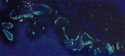
Google Maps in collaboration with the Great Barrier Reef Marine Park Authority now has map data and updated satellite imagery of the islands, reefs, cays, and rocks of the Great Barrier Reef off the Australian coast.
The new satellite imagery of the reef is spectacular.

And the new map view isn't bad either.

Via: Google LatLong: Diving into the Great Barrier Reef
________________
The new satellite imagery of the reef is spectacular.

And the new map view isn't bad either.

Via: Google LatLong: Diving into the Great Barrier Reef
________________
Labels:
Google Maps
Thursday, September 25, 2008
Traffic Added to Google Maps England
Google have added traffic data for England today.

Traffic information at the moment is limited to motorways and major A roads and all traffic stops at the borders of Scotland and Wales.
The traffic tool with Google Maps comes with two options, 'live traffic' and 'traffic at day and time'. The live traffic option is self explanatory but the 'traffic at day and time' option lets the user check a particular time predicted against past conditions.
__________

Traffic information at the moment is limited to motorways and major A roads and all traffic stops at the borders of Scotland and Wales.
The traffic tool with Google Maps comes with two options, 'live traffic' and 'traffic at day and time'. The live traffic option is self explanatory but the 'traffic at day and time' option lets the user check a particular time predicted against past conditions.
__________
Labels:
Google Maps,
transit
Sunday, September 21, 2008
Google Maps Drop NavTeq
Google Maps are now only using TeleAtlas map data. Google Maps, the Google API and Google Maps for Mobile now all use the same underlying map data.
The only exception is Israel where Google still use GISrael in Google Maps and Leaddog in the Google Maps API.
Via: Mapperz & Blumenthals
GRB 080913 - A Blast from the Past

On September 13 the Swift Satellite recorded the electromagnetic radiation of a high-energy explosion that took place 12.8 billion years ago. This is the oldest and furthest gamma ray burst ever recorded, from when the universe was only 7% of its present age.
Ogle Earth has created a Google Earth KML file containing an image overlay of the burst. You can view the file in Google Earth or you can view it in the browser based Google Sky. To view the overlay in the browser version of Google Sky right click on the kml link, copy the link location and then paste the kml link into the search box of Google Sky.
Via: Ogle Earth
__________
The only exception is Israel where Google still use GISrael in Google Maps and Leaddog in the Google Maps API.
Via: Mapperz & Blumenthals
GRB 080913 - A Blast from the Past

On September 13 the Swift Satellite recorded the electromagnetic radiation of a high-energy explosion that took place 12.8 billion years ago. This is the oldest and furthest gamma ray burst ever recorded, from when the universe was only 7% of its present age.
Ogle Earth has created a Google Earth KML file containing an image overlay of the burst. You can view the file in Google Earth or you can view it in the browser based Google Sky. To view the overlay in the browser version of Google Sky right click on the kml link, copy the link location and then paste the kml link into the search box of Google Sky.
Via: Ogle Earth
__________
Subscribe to:
Posts (Atom)
Popular Posts
-
Here again is another (the 11th) roundup of the latest Google Maps Creation (and Viewing) Tools and Resources. I've assemble these list...
-
+ = Google Maps Mashup Roundup Part 1 (of 2) ( See Part 2 here.. ) Google Maps is powering the Web 2.0 craze here in Canada . It is bringi...
-
Massachusetts contributions to gubernatorial candidates - Faneuil Media dropped by to tell me about a very interesting and eye-opening Goog...
-
Boston.com has used the previously mentioned Atlas Google Maps tool to create a map of the recent Mooninite scare in Boston . You might re...
-
"Starting today, we must pick ourselves up, dust ourselves off, and begin again the work of remaking America. " Barack Obama's...