Blog Archive

Thursday, August 31, 2006

First Qatar Google Maps mashup

Update (Sep.4/06): The post title might be misleading - http://www.dohamap.info/ was launched last August and should enjoy the "first mashup" title for Qatar. :)

With the recent addition of Google Maps high-resolution satellite imagery in the Middle East region the tiny Arab country of Qatar is now officially on the map! In-country website QatarLiving.com is making use of this new imagery by establishing the Interactive Doha Map that allows users to plot "places" on the map with a description and image. The new mapping service allows users to plot where they are from in order to show the diversity of people living in Qatar since some 80% of the approximately 800,000 residents are expats. The satellite imagery for the city of Doha and the entire country makes for interesting sightseeing as well. Lots of construction, lavish hotel properties and some pretty impressive residential homes can all be seen by panning and zooming around Qatar from this mashup. The Interactive Doha Map will help bring these visible locations to life! :)

Related: Flickr: Qatar

Do you know of any other Google Maps mashups in Qatar, Saudi Arabia, United Arab Emirates, Kuwait, Bahrain or Oman? If so, please drop me a line or post a comment!

Educational uses of Google Maps

With the 2006/2007 school year nearly upon us across the northern hemisphere educators everywhere are getting their classrooms ready and fine tuning curriculum. Google Maps (and mashups) are free, interactive educational tools that allow students to easily learn more about the world they live in. If you're looking for ideas, here is a collection of links that will give you ideas and show you how Google Maps and Earth is being used at the school level. Parents could even use these ideas with their children at home as well.

Teachers Teaching Teachers: Sharing Stories with Mapping - A 49 minute Mp3 audio file that invites listeners to "Join us to share ways that we have and that we are planning to use Google maps or mapping in our schools. How do our newest technologies encourage us to expand our use and study of mapping in the classroom and in the digital story room?"

Use Google Maps Mashups in K-12 Education - A blog post that outlining how Google Maps tools and mashups can be used to map walking routes, measure area and teach earth science.

A Windowless Room With a View: How Digital Mapping Tools Can Change Our Perspective on Learning - One part in a 3 part series. Here is the description: "This article examines the digital macro-point of view and more specifically the rapidly evolving world of geospatial tools that are accessible to educators and students like Google Earth. This means they are free, guided by open source development, and easily mashed with other digital information."

Educator website uses Google Maps to connect students with pen pals - TheTeacher'sCorner (.net) allows teachers to plot their school on a Google Map in an effort to locate pen pals for their students. Narrow the map pins displayed by grade and other options.

Google Maps Mania Mashup Categories of note: Weather and Earth, History Maps, Travel and Tourism, Google Maps Viewing Tools

Google Earth:

Back to School - Educational Uses with Google Earth (From the Google Earth Blog)
Educational use of Google Earth Free in schools, universities is allowed (From the OgleEarth Blog)

Other School-related Google Maps Tools and Mashups:

  • NEW: LocalEdu.com helps you find local post-secondary schools - Using Google Maps this new tool lets you plot schools based on your zip/postal code in the US and Canada. This helps to reduce commute times and gas expenses. [Thanks to Adena at the All Points Blog!]
  • Top US High Schools
  • Top US Bus Med Eng Schools
  • Easy US School Search
  • Portland Schools
  • UK School Map
  • School Performance Mapping In California
  • U.S. School Search
  • All US Schools
  • San Francisco School Information
  • Mapping UK schools to postcodes
  • Create a School Boundary Map
  • Related Google Maps Mania Post: Find off-campus housing on Google Maps
  • Wednesday, August 30, 2006

    Beginning Google Maps Applications with PHP and Ajax

    Have you been interested in creating your own Google Maps mashup but have just put it off? Beginning Google Maps Applications with PHP and Ajax (Apress, August 2006) is a new book to help you take advantage of the Google Maps API in your own maps mashing endeavors - whether you're an enthusiast playing for fun or a professional building for profit.

    Going well beyond the basics, the authors cover methods to enhance the user interface, ways to optimize and scale for large data sets (over 120,000 points!), how to create advanced custom controls and even some of the high-school math needed when playing with polylines and areas on a sphere.

    If you're looking for a book review, Slashdot gave it a 8/10 on Monday . If you want to get your hands on a copy, you can purchase it here or the authors are holding a random-draw contest to give away three copies of the book at their official companion website (which ends September 7th, 2006).

    Just for the record, I wrote the foreword for this book, thus my name appears on the cover. However, I don't get any sort of royalty and at most, I get a small commission from Amazon Affiliates if you buy using my link. :)

    Tuesday, August 29, 2006

    2 Cool New Google Maps Viewing Tools

    Google Maps metaviewer lets you fade maps together - This new viewing tool could be described as a "meta maps mashup" of several mapping services, which includes Google Maps. While some other Google Maps viewing tools allow you to toggle on/off other mapping providers, most only permit you to view one layer at a time. Ocarto allows you to select a few layers at a time, increasing and decreasing the transparency of each, to allow you to perform a true meshed overlay view. The interface is clean and easy to use and sliding the maps layers on and off is really fun to do. Map providers include Google Maps, Yahoo! Maps, Microsoft Virtual Earth and Terra Server. You can even save your current view as a link or send it via email. Very cool tool!

    3D Google Maps shortcut to Google Maps - Toddy Marx of Germany has created a way to select a location on Google Maps by using a Shockwave based globe as a starting point. (Up to date Shockwave Player is required) It's rather simple. Spin the globe (in much the same way you spin it in Google Earth), then double click on the area of the globe you want to view in Google Maps. For note, I wanted to zoom in on the globe before selecting but unfortunately this is not possible. Toddy writes: "I hope it brings a little bit of the Google Earth feeling into Google Maps."

    Other great Google Maps Viewing Tools:

  • ACME Mapper
  • PowerMap Google Maps Viewer
  • EarthTools
  • Idelix GMaps Viewer
  • Back Country Maps
  • Still more here..

    New US Google Maps Mashups: Red Light Cams, NYC Parking and more!

    Google Mapping Red Light Cameras in 16 US Cities - Photoenforced has just launched a unique road maps mashup for drivers in 16 US cities. Google Maps is mashed up with a database of red light cameras, plotting their exact locations and the associated fine for being caught on these cameras for running a red light! Browse cameras for your city from this Google Maps starting point or do a more thorough database search from the main page. How many red cameras are you being watched by on your way to work? Now, if only Google Maps for Mobile would integrate this into their live-traffic overlay feature! :)

    Find Parking in New York City on Google Maps - Here's a great mashup for New Yorkers or tourists in the city looking for parking. The search for parking spots drills down from daily or monthly parking then to neighborhood, address, cross street or attraction. Select your entry and departure times and lots that match your search are plotted onto a Google Map for you. The "Attractions" search will help you find parking near Sights, Museums, Theaters, Sports & Exhibitions, Hospitals, Shopping and Hotels. This is a functional, useful and very well designed interface with a nice big map view to browse around on. (More NYC mashups here) [Via Curbed.com]

    Pete Ashdown U.S. Senate campaign signs - People can even upload pictures of their homes with the sign to the map. Check out this interview with the mashup creator for more insight.
    South Carolina Department of Motor Vehicles - State officials integrate Google Maps API to display office locations and details.
    California Online Streaming Radio Map - Showing local radio stations that broadcast on the Internet. [via]
    US Zip Code Map Update - Now uses ZCTA zip code polygons from the 2005SE Tiger/Line files. Far more accurate - This page shows the differences as an added layer. Give it a try! (This blog will keep you up to date on changes to this useful Google Maps tool).
    Crime Mapping - I have corrected the link I have on the right sidebar. Be sure to take another look at this great mashup - it was one of the first during the initial mashup craze last year!
    Google Map of 19th Century Baseball player photographs

    Monday, August 28, 2006

    Google Maps Movie Map: Napoleon Dynamite

    + = DynamiteMap!

    Fans of the 2004 movie Napoleon Dynamite might be interested in seeing this new Google Maps "Movie Map" for the film called.. DynamiteMap. Google Maps has been used to plot the places from the real life town of Preston, Idaho which is depicted in the movie. Locations like the Bowling Alley, Grocery Store and High School are all there, along with events like Kip and LaFawnduh's Wedding. Each location is browseable by scene screen capture or text list. Google Maps compliments this movie fan page which also includes a video clip of David Letterman's Top 10 list and mp3 sound bites from the movie.

    Even if you haven't seen this movie, I've put together a section here on Google Maps Mania where I'm tracking other known Movie Maps that have used the Maps API to plot locations or give movie goers the chance to further interact with the film and real life locations where scenes from the movie take place. In some cases these are actually integrations into the film's official website. Here is a list:

    Do you know of a Google Maps Movie Map that isn't mentioned here? If so, please post a comment! If you have an idea for a Movie Map get one created (Try: Community Walk or the API) and drop me a line once completed so I can include it in the list!

    Related:
    Internet Movie Database - Napoleon Dynamite
    Google Maps TV Maps

    [Found Via Digg]

    Friday, August 25, 2006

    World Airports and Time on Google Maps

    World Airport Explorer - From the creators of GeoWalk comes this awesome world airport explorer. Available in English, German and English it displays all primary and secondary airports for all countries around the world. To get started click here and choose your language from the flag key at the top right. Drill down from continent, area, country then region to view all airports. Primary airports are marked with an airplane marker and smaller airports with colored pins. Each airport mashes up with Wikipedia entries (where available) and Flickr images tagged for that airport! Very cool.

    It's worth mentioning that the above mashup is born out of another really cool Flickr + Wikipedia + Hotel info mashup for world locations. It's called GeoWalk and I've mentioned it before. Tap anywhere on the world map and it gives you pictures, information and hotel info for that very spot. Neat for preparing for travel or while you're on the road and want to learn more about your present location!

    Google World Time Map - This is not a new Google Maps tool concept but the interface and method to learn the time is. Roll the mouse over the map and the info-window instantly displays the present time for that location. GChart is another good world time map concept with other data mashed up for you to explore on.

    Recent Google Maps Mania Country Roundups


    I've been trying to put together comprehensive posts containing all known Google Maps mashups for countries where I'm seeing the most mashup activity. Here is a list of the recent posts that I've done:
    ..In the next few weeks I'll be continuing with roundup posts for Canada, Italy, Greece, Qatar, Spain, Ireland and various countries in South America. Are you seeing mashup activity from a particular area not mentioned here? If so, please contact me with the country and the list of maps that you know exist! :)

    Thursday, August 24, 2006

    I want my MTV Google Maps

    +
    MTV has spruced up the 2006 Video Music Awards website using Google Maps. To view the map click here and choose "LIVE NYC" from the main page. Visitors to the site can truly experience life in New York City by browsing cool celeb hangouts, watching videos and even add their own location to the map to share with others. Check out the legend at the top to learn what each of the symbols are marking. Sound, video and a cool Google Maps design. The only down side to the integration is that it doesn't seem to be working very well in Firefox, so this mashup gets the "Best viewed in Internet Explorer" warning.
    [via]

    Related:
    New York City Google Maps Mashup Roundup

    Wednesday, August 23, 2006

    A Google 3D Maps Mashup

    :

    The Google 3D Warehouse is a database of 3D objects that people from around the world have built using the software application Sketchup. These objects are intended to be opened in Google Earth. The web front-end to this database has been recently revamped, as reported by Frank Taylor over at the Google Earth Blog. The redesign includes a Google Maps view of each 3D object with location based significance, or those that are actually real. These 3D objects are available for viewing in Google Earth (or editing in Sketchup). Along with this redesign being a great compliment to browsing these objects, for specific location-based landmarks such as the San Francisco City Hall (pictured above) it's a great way to actually see what is in that satellite photo you are viewing on Google Maps. Take things a step further by viewing it in Google Earth to get the full experience of almost being there!

    Here are some examples (Toggle to 'satellite' view and zoooom in on these!):
    Haven't yet downloaded Google Earth? Run, don't walk, here and GET IT!! :) Google acquired @Last Software, makers of Sketchup, back in March and since then have integrated this ability to create and 3 dimensional objects into the core of the Google Earth application. You can browse the 3D Warehouse to choose buildings or objects to import into Google Earth, creating a true virtual reality world inside this amazing geo-browser. Don't forget that Google Earth also contains it's own built in web browser enabling you to cruise mashups here on Google Maps Mania while simultaneously taking a closer 3D look on Google Earth!

    Have fun!

    Tuesday, August 22, 2006

    Germany Google Maps Mashup Roundup

    +

    Welcome to our first big roundup of all German Google Maps Mashups. Stefan from the German Google Maps blog Google Karten helps out with most of these links so be sure to tune into his blog for all the newest German Google Maps mashups.
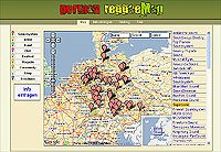
    ReggaeMap is a site that visualizes the german Reggae-Scene. It shows artists, bands, festivals and more. Any kind of information about Reggae, Ragga & Dancehall music which is location-based is plotted onto a Google Map for you to browse.

    PTViewer - Shows neat images of German locations in a very cool panoramic viewer

    German & Worldwide Airports Mashup - Plots locations of all major and secondary airports (English toggle available)

    Golfplatzfinder - Search for golf courses in a 20, 50, 100 KM radius of a given location [via]

    Mapits.de is Germany's first Google Maps based real estate search engine. It's possible to search for houses, apartments, and commercial facilities. The map is powered by ImmobilienScout24 which has more than 100,000 properties.

    MyMaps24.de - Here is another Google Maps based real estate search engine. [via]

    ImmDex.de - Real estate search engine that uses Google Maps
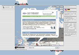
    With Geojob.de you can search for jobs by region. Just click on the map and get all job offers in that area. The info window shows a list with jobs and some Google News related to the location. Geojob.de can search for jobs in Germany and the United States.

    ICJobsMap Germany - Another Google Maps jobs search engine. [via]

    The parents initiative of missing children represents organizations for missing children in Europe and plots last-seen locations of children on a Google Map. The newest search messages are also indicated clearly on a Google Map.

    Schwarzwaldbike indicates Events, Shops and Routes in a Google Map. The map even features an elevation profile.

    The Track Viewer makes it possible to show tracks from a GPS-File on a Google Map. All you need is a Track-File in GPX-format. This file can be uploaded in the Track-Viewer to get the data on Google Maps.

    Google Maps Help and Tutorials:
    PlanetGMaps is Germany's first Google Maps online community. The goal of the site is it to bring people together which are interested in programming with the Google Map API. The site offers a Linklist, a Wiki and a Forum.

    Testticker.de published an article which describes the installation of a Google Maps into a web page. The article is divided into the several chapters.

    Last but not least there's a new Google Group called Google Maps DE where you can discuss the Google Maps API in German.

    Previously mentioned Google Maps Mashups and tools for Germany:

    Find off campus housing on Google Maps!

    GoOffCampus.com is a new US Google Maps mashup where students and landlords can list their apartment rentals for free. Thomas Taylor a student in Raleigh, NC has this to say when asked if about how he is mashing up the data: "I don't believe in just simply copying all the data that is on Craigslist like many of the sites out there, so I have chosen not to use the XML feed from that site as a source of listings, but rather rely on property owners who want to only list their rentals once and give them the ability to manage unlimited listings."

    Currently, the most popular schools in terms of traffic and listings are:

    NC State University
    UNC Chapel-Hill
    Duke University
    U. Texas at Austin
    UNC Charlotte
    University of New Mexico
    Georgia Tech.
    UGA
    UCLA

    With the US school year fast approaching this is a great mashup and resource to secure housing for the fall term!

    Other Campus Maps:
    Do you know of a college campus related Google Maps mashups not listed here? Please post a comment to let others know!

    Monday, August 21, 2006

    UK Google Maps Mashup Roundup Part 3

    Old Ordnance Survey Maps - Here is a great Google Maps viewing tool that mashes up a selection of out of copyright Ordnance Survey maps from the 1920's to 1930's with the Google Maps API. The result is a great tool to overlay maps from two eras and adjust transparency to see the changes in the cityscape. This is a great example of paper map cartography meets web 2.0 online mapping and really gives you a nostalgic feeling when fading the old maps to new (and vice versa).

    Find UK Tourist Information with Timaps - Timaps (Tourist Information Maps) is a new Google Maps mashup that plots the locations of thousands of visitor attractions including museums, gardens, historic houses, castles, art galleries, cathedrals and theme parks. Each attraction has been categorized and is displayed on the map as colour coded icons. Each map pins includes information about the attraction and links to the official website. You can even save your favourite places and display them on your own custom map! Check out this link for more details..

    Bournemouth Tourist Maps - Here is a great local tourist map created by local resident Rob McMahon. His maps can be browsed or searched, and a fullscreen option is available. Detailed profiles are available and users can contribute by adding places and information to existing places. Bournemouth features interesting attractions such as Badbury Rings, an old iron age fort a bit to the north of Bournemouth, along with what appears to be a great beach! Be sure to check out the great on-map interface design as well as the search options. Very well done!

    Google Maps for UK tourism and leisure - UKSeries.com is a suite of sites dedicated to tourism and leisure in the UK. They have recently integrated the Google Maps API into sites that help you find places to eat, visit and stay. This should help any tourist traveling in the UK. (More info here)


    Localbrit makes local searching easy with Google Maps - Localbrit is a new local search based on easy input, easy search and easy results mapped out for you on a Google Map. It features some nice vibrant design and easy to use interface.

    UK Recycle Now website features post code search with Google Maps result - Enter your post code or try out SO40 3PJ to see the map in action
    Google Map of Cottages in Scotland - An interesting way to drill down and browse property listings

    Have you created a mashup of your own or want to get started on one? Be sure to check out details of the BT Exact Mashup Competition running until October 6th. Top prize is £2,500. Read more details on ProgrammableWeb.com or stop by the official site for more information.

    Past roundup posts:

    UK Google Maps Mashup Roundup Part 1
    UK Google Maps Mashup Roundup Part 2

    Google Map of Shanghai subway system

    Shanghai Subway Map - Shanghai is a city that does not have street mapping from Google Maps as of yet. This subway map however will help you if you are matching recognizable Shanghai landmarks with the subway system there. If you know the city well it also acts as an interesting way to explore the city. Wikimapia's Shanghai descriptions might help as well.


    More Google Maps for China:

    Recent Post: Google Maps Mania in China - A roundup of all known Google Maps mashups and tools for China
    Recent Post: Hong Kong Google Maps mashups

    US Google Maps Mashups: DC Crime, US Schools, Congress Bills

    Washington DC Crime Map - After the wave of US crime maps some months ago it's been a while since a good one has well built crime map has come along. CrimeInDC.org is a great Google Maps Crime mashup that maps all types of crimes to their very location back as far as 2001. This map has great user interface design and search, along with some great pins for the map. Search for crimes in the US capital or neighboring Arlington Virginia. [Via]

    US PK-12 School Search - Easy School Search is a new Google Maps mashup that combines a database of over 130,000 public and private elementary and secondary schools.. with Google Maps. Use this in your real estate search by entering a particular zip code or by freetext search in a particular state. The search results plot each school on map and also give an enormous amount of information about the school, as well as a driving directions tool. It might even be interesting to plug in your own child's school to just learn more about where they are attending!

    Mapping 1,753 earmarks in the 2007 Appropriations Congress Bill - An earmark is a line-item that is inserted into a US Congress bill to direct funds to a specific project or recipient without any public hearing or review. This Map shows you those earmarks. More info here.

    User-Submitted US Cell Coverage Map - An independent consumer driven website that aims to improve cellular phone service in the USA has created a map of the last 25 user submissions. Submit to the map here.

    Google Maps Mania - A Week in Review

    Off on holiday last week or miss some posts? Here is a summary of all mashups and news mentioned last week:
    Check each entry for more information and detail..

    Sunday, August 20, 2006

    Google Maps mashups for France

    :
    Drive in a Ferrari through the streets of Paris - A while back (perhaps even a year ago) I made mention of a map that was created using Google Maps of the 1978 short film, "Rendezvous" set in Paris. The map has been taken a step further on bhendrix.com where the film is played in a small Google Video window, while below the route is drawn for you as the film progresses. Switch to satellite mode and you can follow along all the twists and turns this Ferrari 275 GTB makes as the driver speeds toward his awaiting lover. It's a pretty wild ride! (Follow the instructions carefully and be sure to hit the "GO" button right at the 4 second mark!)

    More Google Maps mashups from France (All are in French language):

    Geo-Trotter - A french language "collections" site with interesting satellite images bookmarked to view
    Yakaz - Local search engine for classified advertisements. (Check out this related article)
    Zagaz - Community driven fuel price site mapping gas stations and current prices. Lists ALL gas stations in France.
    Lokaliz - Google Maps + eBay France search mapping tool
    (Thanks to our French correspondent Renaud Euvrard for these above links!)

    More Google Maps France links:

    Google Maps France - Official Google Maps site for France
    Wikimapia: Paris - Zoom out for more places in France, or switch to "French" language
    Zorgloob Maps - From the popular Zorgloob Google Blog
    Past Google Maps France roundup posts: May 21/06, June 4/06

    Saturday, August 19, 2006

    Google Maps Creation Tools and Resources - Part 8

    There are so many great tools, how-tos and examples out on the web and in the blogosphere for creating and enhancing Google Maps mashups. Here is my eighth roundup of these examples that I've found over the past several weeks..

    New Google Maps Creation Tools:
    Do-it-Yourself Google Maps sites' News:
    Viewing Tools and Websites:
    Mashup Resources:
    Alternative Google Maps API Examples:
    Previous Creation Tools posts: [Part 7], [Part 6], [Part 5], [Part 4], [Part 3], [Part 2], [Part 1]
    Related Links:
    Viewing Tools and Creation Tools

    Friday, August 18, 2006

    Flickr + Google Maps = Loc.alize.us

    + = Loc.alize.us

    Okay. This is one of the cooler mashups I've come across in the past little while. Loc.alize.us is an awesome mashup that combines the popular photo sharing site Flickr with Google Maps! It allows you to cruise Flickr photos, tags and people based on geotagged location. The interface is great! As you center and zoom on the Google Map a selection of 50 Flickr pics for that current zoom level are displayed. As you hover over a thumbnail an arrow quickly shows you what location on the map the picture is taken from. From there, the picture viewer brings the photo up in large size with a descriptive text overlay that can disappear if you want a good look at the photo. Loc.alize.us also gives you a how-to (see: 'create' tab) on geocoding your Flickr pictures so they can be displayed in this way (You can also use this geotagging tool or a similar tool from Blockrocker). Geodevelopers Sumaato Labs acknowledge the components that go into this application: "Address search is provided by Google and GeoNames.org. Photos are shared via Flickr and satellite imagery via Google Maps. Programming frameworks are based on Helma and Prototype." Check out more details about Loc.alize.us here. Let's just hope the recent Picasa Web Albums "test" launch will spawn this kind of photo mashing..

    More Google Maps-Flickr Tools & Apps:
    Recent Google Maps Mania Post:
    Mapping Your Photos with Google Maps
    (A roundup of other Google Maps based photo mapping resources)

    8 new US Google Maps mashups


    Thursday, August 17, 2006

    New Zealand Google Maps Real Estate Mashup

    +
    = New Zealand's first Google Maps Real Estate Mashup!


    The Google Maps mashup scene is starting to pick up! New Zealand real estate group Harcourts has taken hold of the Google Maps API and fully integrating it as a centerpiece in their property map search function. The integration can be found on http://maps.harcourts.co.nz/. The main page even greets you with the Google Maps logo! Making use of recently released street maps for New Zealand, the application searches based on the usual property types and number of bedrooms, with the resulting search being plotted on a Google Map for you explore. There are great street and road maps with great detail and the satellite imagery speaks for itself with awesome clarity. The fact that New Zealand is such a stunning country helps as well. :) [Hat-tip to Fraser Mills for this suggestion!]

    Since my last NZ update there have been a few new mashups and some blog chatter. Here is an update:
    Did you catch my last New Zealand Google Maps Mashup Roundup?

    Google Maps for Mobile now supports KML

    An article from the Press Telegram highlights an official announcement expected today from Google about some exciting new functionality on Google Maps for Mobile: New functionality now allows you to view a Google Earth KML file inside Google Maps for Mobile!

    KML files are information overlays opened inside Google Earth (or in some cases Google Maps) and feature a placemark, image or polygon. Think of them as the mashup viewing component for Google Earth. This will now allow you to view KML files which have been posted on the web on your Google Maps for Mobile application on your mobile phone or PDA.

    To try this out, do the following:

    1. Open Google Maps for Mobile on your mobile phone or PDA (Download it here)
    2. Select "Find Business"
    3. Select "Enter a new search"
    4. Type in: http://dev.keyhole.com/trek/StarTrekPlaces.kml
    5. Start to view placemarks for the KML file!

    ..Viewing each placemark on Google Maps for Mobile is cool too since you move from placemark to placemark by just keying in numbers. The viewing experience is very similar to jumping from point to point in a series of turns in a regular street maps directions search on Maps for Mobile.

    Google will be making this announcement at a Star Trek convention today attended by an estimated 15,000 people, according to the above-linked article. The page they have set up to launch this feature is intended for Trekkies attending this event and this example KML file I've chosen above shows points of information for the convention. Visit the information page here: http://www.google.com/trekfan. From a marketing perspective, this really shows the possibilities for Google's mapping technology for events or conventions. You could create a KML file that is posted on your event website for Google Earth users to view, and now Maps for Mobile. The file can also be viewed in Google Maps, although you could create a more sophisticated mashup with more detail in the info-windows.

    Google Video about
    KML on Mobile:

    KML integration into Maps (Desktop of Mobile) is not perfect. Not all KML files are viewable in Maps for Mobile. It's a good idea to cut/paste the full URL into Google Maps first, then key it into a business search on your phone. That said, does anyone reading this post know of a list of good KML files that view well in Maps without errors? Typically files with only a few placemarks are best since large numbers of placemarks get truncated when viewing it on Maps.

    All in all, this is a great feature that further integrates Google's mapping products (Maps, Earth and Maps for Mobile) with each other. It should spawn further KML development and "unearth" more web-hosted KML files out there that will be useful to view while on the go. For mashup developers out there when creating your Google Maps mashups, don't forget to create a KML file for Earth and Maps for Mobile users to view! This should be the beginning of a new wave of Google Maps mobile mashups by way of KML...

    Related:

    [Credit to the Press-Telegram for the tip!]

    Wednesday, August 16, 2006

    Google Maps 7 Wonders of the World

    Juan Taylor has created a cool little mashup project where he takes 7 wonders from various "worlds" and maps them onto a Google Map for all to explore. Each of the maps contains a list with quick-zoom functionality that brings you down to the location so you can take a closer look on a Google satellite map. He provides a way to learn about the locations with short descriptions and the option to link off to a Wikipedia entry for that place, offering more detailed info. Check out some of the maps he has created:

    7 Ancient Wonders of the World
    7 Medieval Wonders of the World
    7 Modern Wonders of the World
    7 Natural Wonders of the World
    7 Underwater Wonders of the World

    Google Map of Fatal Crashes in the US

    Mapping Fatal Crashes - CrashMaps takes combines up a database of fatal crashes in the US from 2001-2004 and maps them onto Google Maps. Searching options for this app include a city and zipcode search along with a method to draw your own polygon, then search within that zone for fatal crashes. You can even search for fatal crashes along a given driving route. Map markers indicate a drunk driving fatality, pedestrian fatality, or other fatal accident. There are many uses for this site. For example, you could reference an area you're about to purchase a home in if you suspect the street safety might be at risk or you could use the drunk driving fatality search to draw awareness to a growing issue in your city. Consider using the driving route search to determine how safe your commute is. Either way this a very eye-opening web mapping application. [Found Via ProgrammableWeb.com]

    Bay Area Rapid Transit (BART) Google Maps mashup

    Here is a new Bay Area Rapid Transit Map which joins some other BART maps already listed here on Google Maps Mania (Search in-page for BART). This BART map has a great way to select stations and interact with them by zooming in and out easily, link directly to the official BART webpage for that station and also view the full schedule for that station. Map markers are multi-colored if several stations are served by that line. To use the mashup to plan a trip between stations, click on the 'Plan Trip' tab, select two stations and the calculator will tell you the departure and arrival times, along with the travel and time and fare. I wonder why is it taking municipal transit authorities so long to catch on to technology such as the Google Maps API?

    More Google Maps Transit Maps Here (look right)

    Popular Posts