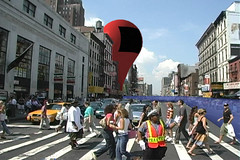
Thickey got an idea: Combine her Flickr account and Google Maps..
She writes:
After a little more research I found someone had done the hard work and produced some code that enabled me to effectively serve Google maps from my webserver and inject an XML document with the various plots and html code needed.
Here is the end result.. This is a great idea to create a jump off to pictures of a tour through a number of countries or points within a city!
[via]
Saturday, April 30, 2005
Satellite view lets person ponder death of his hometown
The Yesbutnobutyes-Guy ponders the death of his hometown through a Google Maps satellite image.
He writes:
This is an image of the killer, the Amsterdam Mall. Celebrated as the future of the city when it went up. Holzheimer and Shaul women's clothing, Mortan's Men's Store, Lumart's shoes...stores that had been part of the community for decades, they all moved in immediately, as malls were the rage in the 70's nd 80's, and we needed one. Now it's a hollowed-out shell, a few professional offices and a chinese take-out place are all that remain. You see that road that it's basically sitting on? That was Main Street. The few buildings to the left that remain...they're all empty. (Read more and see the image..)
Mapping the Scottish Common Information Environment
Mapping the Scottish Common Information Environment, with a little help from Google - Gordon Dunsire describes how the simple incorporation of Google Maps within information services can add value for users
From the article:
An organisation can display a Google map for its location by proving a link from its website. The link has to use the full URL with the CGI parameters; specifying a postcode will provide an unambiguous result. This is a simple and effective way to provide a useful map of the organisation's location, with the facilities for identifying other organisations in the area, and for generating travelling instructions.
There is nothing in the Terms and conditions of use on the Google Maps website to prevent linking to Google Maps using such pre-set searches, so this is a great way to add valuable functionality to information services for little cost.
[via]
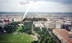
An awesome TerraServer-Google Maps marriage
I love reading about the coding adventures and the how-tos that people are posting on blogs about hacking Google Maps. Everyone seems to really be having a great time learning about how Google works and combining this with their own knowledge of customizing it to something that they want. This link is no exception:
David has created a combination of Google Maps and TerraServer map interface of a point near the White House in Washington DC, USA. On the map you have the option of viewing a Topographic, Black & White Overhead, Urban (All TerraServer views) and Street Map and Satellite view (which are all the Google Maps views). It uses the same zoom tool that Google Maps does. I'm amazed with the detail in the "urban" view and it even looks a bit better than the Google Maps satellite view. This is really an awesome marriage of two different mapping tools. I just hope David makes more!
David has created a combination of Google Maps and TerraServer map interface of a point near the White House in Washington DC, USA. On the map you have the option of viewing a Topographic, Black & White Overhead, Urban (All TerraServer views) and Street Map and Satellite view (which are all the Google Maps views). It uses the same zoom tool that Google Maps does. I'm amazed with the detail in the "urban" view and it even looks a bit better than the Google Maps satellite view. This is really an awesome marriage of two different mapping tools. I just hope David makes more!
More transit maps cropping up..
The DC Metro system joins the already available NYC subway maps on Monkeyhomes.com
Mac OSX plug-in for Google Maps and Address Book

New extension for Mac OSX allows you to add Google Maps locations to Address Book - GMAP stands for Google Maps Address Book Plug-Ins. What is it? Well, it's a pair of plug-ins for Address Book that allow you to get maps and directions from Google Maps. Just click and hold on the address you want mapped and select the choice you would like.
Take a closer look here.
Funny LJ post about Google and Google Maps
This post by LiveJournal user Didymos pretty much says it all:
Google maps. Seriously. Buh-bye, MapQuest, it was nice knowing you. MS MapPoint? You have always sucked. Now it's even more obvious just how much. CONCLUSION: If Google does not either stop or slow down in their ass-kicking, future generations may find that there is no more ass to be kicked, for Google has kicked it all.
How true...
Found.City.and.Google.Maps
It looks like Google Maps is finding it's way into another emerging urban net-tool. It's called FoundCity. Here is the description from their website:
FoundCity is a collective mapping tool. It allows everyone in a city to map the interesting things they discover throughout the day to a dynamic online map, where they can then compare their points of interest with other people's points. In doing so they both share what they like about the city with others, and discover what other people find fascinating about the city. It is an open-ended, continually evolving tour guide to the city.
It uses "tags" similar to Flickr.com. So by clicking on the tag "cool.building" you'll end up at a map plotting for you describing a slanted wall w/ circle windows at 346 w and 17th st. The site goes on to say that it is just available in Manhattan for the moment.
[via]
Thursday, April 28, 2005
Google Maps used in new Ride Finder
The Google Product Management department has another young one in the "Google Labs Nursery". It's called "Ride Finder" and it displays cities in the US where there are taxi or shuttle locations for you to get to for rides. There is a link at the bottom labelled: "Information for Fleet Operators" that upon clicking on it reads:
If you'd like to include your vehicles on Ride Finder, please take a moment to fill out this form. We'll get back to you within a week.
I wonder if this is the start of another revenue generating search tool that could see charges to these fleet operators? Or perhaps it will make the Google Adwords keyword space for bus companies and shuttle services more profitable by creating a portal that everyone is visiting.. and clicking on ads. (/end Google conspiracy theory)
The Ride Finder makes use of Google Maps data. Along with Google Local, this is the only other service that I know of that Google is using Google Maps data in.
Google Maps helps facilitate Greenland expedition..
The "Google Maps hacks" continue. The company Guardian Mobility has outfitted two people and a team of dogs who are skiing around Greenland on and exploration of the country with a wireless data unit. Guardian Mobility, says:
She has been outfitted with one of our Tracer units which has a GPS receiver and send data to our backoffice through Globalstars Low-earth orbit satellite network. We're tracking her progress using Google Maps and using MyGMaps. to map multiple points onto Google Map's satellite imagery.
Here's a screen capture of what the information looks like once displayed on a Google Maps map-image:

..Very cool! If you know of any other sites that are making use of MyGmaps, please post them in the comments section! :)
[via]
She has been outfitted with one of our Tracer units which has a GPS receiver and send data to our backoffice through Globalstars Low-earth orbit satellite network. We're tracking her progress using Google Maps and using MyGMaps. to map multiple points onto Google Map's satellite imagery.
Here's a screen capture of what the information looks like once displayed on a Google Maps map-image:
..Very cool! If you know of any other sites that are making use of MyGmaps, please post them in the comments section! :)
[via]
Wednesday, April 27, 2005
Whimsy inc: "Mapping the Intangible"
There is an interesting post on whimsy inc. titled "Mapping the Intangible". I'll include a really cool excerpt from his posting:
The extension of this is that you can then use Google to map otherwise intangible things. What good are these maps? I'm not sure really. We can observe that desire in Montreal in relatively spread out, while pity is confined mostly to the downtown core. There is a small patch of compassion on the North Shore, and there is inspiration to be found in various places off the island. (Read More)
It's well put and very interesting.. Has anyone tried to enter wacky terms to see where Google Maps takes you?
A prelude of things to come with Google Maps?
Eric Baillargeon of 'SEO & Web Marketing News - North' directs us to what could be a "Google Maps inspired" mapping site in Switzerland. This is a pretty cool mapping tool.
Such is the case with all Google Beta projects, I'm sure more is yet to come from Google Maps. Perhaps aspects of this tool could make its way into Google Maps? If you know of any other cool mapping sites, please post them in the comments so we can have a look!
[via]
Such is the case with all Google Beta projects, I'm sure more is yet to come from Google Maps. Perhaps aspects of this tool could make its way into Google Maps? If you know of any other cool mapping sites, please post them in the comments so we can have a look!
[via]
Google Maps UK on your mobile
Nick shows off Google Maps UK on his mobile phone and says that it is "Quite possibly the most useful mobile site after the UK train times, Gmail and the BBC mobile sites."
Google Maps facilitates teacher-student "connection"
Educator Tim Wilson talks about how Google Maps and "always on" Internet access in the classroom allowed him to interact better with his students.
That quick lesson was just the latest example of how "always on" access to technology can change the way teachers and students operate. No one would march their students down to the computer lab for a 10-minute Google Maps experience. Having the technology in the classroom, ready to use at a moment's notice, makes it possible to blur the line between learning about technology and learning with technology. I get excited when I consider the kinds of questions that these students can ask and answer on their own with the Google Maps site alone. (Read More)
That quick lesson was just the latest example of how "always on" access to technology can change the way teachers and students operate. No one would march their students down to the computer lab for a 10-minute Google Maps experience. Having the technology in the classroom, ready to use at a moment's notice, makes it possible to blur the line between learning about technology and learning with technology. I get excited when I consider the kinds of questions that these students can ask and answer on their own with the Google Maps site alone. (Read More)
Aardvark Firefox extension handy Google Maps printing tool.
Judi Sohn talks about how the new extension for the Firefox browser called Aardvark could be used to print off only certain regions of the Google Maps results page such as the directions portion or map area.
..I looked at a demo of the extension and it's pretty neat!
..I looked at a demo of the extension and it's pretty neat!
Tuesday, April 26, 2005
A Flash-powered Hollywood "cityguide" using Google Maps
The folks at Liquid Generation have created a cool little tour of Hollywood using their flash development skills and Google Maps satellite view. It's called "Google Map of the Stars" and although its a bit more of a cartoon than a serious city guide, this does show the potential that Google Maps has for integrating with existing city guide websites using the satellite viewing capability. (See my recent post regarding this)
A9.com Blockview meets Google Maps
This is pretty funny. Flickr user Kokogiak has taken the A9.com yellowpages blockview and mixed it with the pushpins and annotations that are created when you run directions or address plotting on Google Maps. The result is a pretty funny version of what the world would look like if the pushpins were to scale in our real world.
Can you say Godzilla? :)
Here are the pictures:
[via]
Can you say Godzilla? :)
Here are the pictures:
[via]
The worst places in the world
Dave Pollard's blog has tipped us off about Sprol.com which contains some Google Maps satellite imagery. The tagline of the site boasts: "With Sprol, now you can see the sprawl. We'll take you to the best of the worst places in the world via satellite imagery. Seeing the impact of people from space gives us an important perspective on many issues facing us today." Dave Pollard has this to say about the blog:
Jumping on the Google Maps bandwagon, Sprol is a fascinating blog that shows aerial views of some of the horrible things man has done to our planet, with some well-researched commentary.
[via]
Jumping on the Google Maps bandwagon, Sprol is a fascinating blog that shows aerial views of some of the horrible things man has done to our planet, with some well-researched commentary.
[via]
Monday, April 25, 2005
Google Maps Comic
Take a look at the Google Maps Comic from UComics.com.. Pretty good. The funny part is, I can see some folks actually doing this to their house after seeing Google Maps.. :)
Google Maps "collections" start to evolve
Here is a Google Maps influenced site which incorporates the New York City Subway system overlaid on the Google map of New York City. See my previous post referring to the blog that gives you instructions on making your own transit system map.
I'm starting to see that we are very quickly gathering "collections" influenced by Google Maps. Google Sightseeing and others like it are starting to build collections of "views", attainable straight from the satellite feature of Google Maps. We're also seeing the rise of Google Maps hacks like the NYC and Chicago transit maps, as well as the Craigslist-Google Maps housing sites. Other collections of tools to make use of the "hackability" of Google Maps are also starting to crop up.
I'll do my best in the next week to start to organize these evolving "collections" from my links list. Stay tuned.
NYC link found [via]
Saturday, April 23, 2005
Hey city tourism websites: Add links to Google Maps satellite views!
Okay, not only is Toronto the greatest city in the world but it also has some really good Google Satellite views. Karen Ruby has organized the best of them... From the Skydome (now the Roger's Centre) and CN Tower to the provincial captial buildings of Queen's Park. If you haven't visited Toronto yet, put it on your list. If you're from the States, your dollar goes a looooong way with the exchange rate! While you're at it, visit the rest of Canada! (Can you tell I'm from near Toronto?)
Actually, when you think of it, every city tourism website in North America with good zoom detail of their popular attractions should allow the site visitor to link off to Google Maps and see for themselves what the attraction looks like in real "from-Googlespace" detail.. Perhaps some will start to add this?
Actually, when you think of it, every city tourism website in North America with good zoom detail of their popular attractions should allow the site visitor to link off to Google Maps and see for themselves what the attraction looks like in real "from-Googlespace" detail.. Perhaps some will start to add this?
Google Maps explains bizarre Boston
Textiplication points out a weird Boston highway oddity that has only been visible from the air up until now. For the driver on the ground you may not know what actually exists as you wind around a popular off-ramp. It appears as though a planned road, never went ahead.. or it's ready for when they want to expand the road. Take a look.
[via]
[via]
Found another good Google Maps related site
Here's another good site pulling together unique views, listed by state from the Google Maps Satellite viewing feature. This site is oddly familiar to those early sites that started to appear in the late 90's that listed live cameras by country and state. This is a pretty good list and also points you out to some other unique Google Maps related sites as well!
Friday, April 22, 2005
Google Maps on Tivo
An HME program has been released that allows you to access Google Maps on your TiVo.
Found: New Google Maps Sites
While browsing around Bloglines today I found a new site devoted to Google Maps - "Google Globetrotting". Similar to Google Sightseeing, 'Globetrotting adds another element to the categorized listing of cool views. It allows you to rank the maps and list them based on their popularity. Hmmm.. sounds a lot like another of my favourite sites: Airliners.net :) This site even features a cash prize for good map submissions.. Too cool! At first glance Google Sightseeing holds a slight edge in total coverage with the apparent lack of Canadian mapview content on Google Globetrotting. There are tons more Canadian maps listed and featured on Google Sightseeing.
Another site that was suggested to me by a visitor to Google Maps Mania is "As Good As Being There". 'ASABT' "focuses" more on unique views of particular landmarks or popular places, rather than general unique views of terrain or cities. Theme Parks, and Historical Landmark sections are of particular interest.
Both links have been added to the right sidebar.. Be sure to check them often for cool new views and Google Maps stuff to waste time by looking at. :)
Google Maps meets MLB stadiums
Wesley Rosenblum over at wesbran.com has compiled a list of all of the Major League Baseball stadiums from the U.S. and Canada using the satellite feature of Google Maps. He's even grabbed snaps of some of the fields that were under construction at the time the "Google Spaceship" passed overhead.
Take a scan through the rest of wesbran.com as well.. pretty nifty blog.
Thursday, April 21, 2005
Make your own transit map with Google Maps
Google Maps continues to show what can be done with a few scripts, Photoshop and the satellite map view. Adrian Holovaty has created a how-to for people wanting to combine a city transit map with Google Maps.
Here's his "How I did it":
Here's his "How I did it":
- Downloaded the CTA's official maps and combined them into a single image in Photoshop.
- Downloaded a bunch of Google map tile images for reference, noting the coordinates in their URLs (example), and spliced them together.
- Stretched and skewed the CTA map so that it was aligned as closely as possible to the Google map. This was the most time-consuming part of the process, and it didn't turn out as perfect as I'd have liked. I blame it on the CTA map designers for not being precise enough. :-)
- Chopped the aligned CTA map into 128-by-128-pixel tiles that matched their corresponding Google map tiles exactly -- by size, shape and coordinates.
- Wrote a server-side Python script that handles dispatching images. (Ideally a future version of the Greasemonkey script would embed the map images in itself directly.)
- Wrote the Greasemonkey script that brings it all together.
Tuesday, April 19, 2005
Google Maps UK launched..
Google has launched a UK version of Google Maps. The service doesn't include satellite imagery just yet, but does include all the regular colour-rich mapping data, directions and local searching for that trusty local pizza parlour.
Google Maps comes in addition to the previously released Google Maps on the .com domain name. I suppose this makes http://maps.google.COM - Google Maps North America? Does anyone know of any other Google Maps in other geographies?
Google Maps comes in addition to the previously released Google Maps on the .com domain name. I suppose this makes http://maps.google.COM - Google Maps North America? Does anyone know of any other Google Maps in other geographies?
Sunday, April 17, 2005
April 6th Google Maps searching..
Google Blogoscoped has tipped us off on an image which plots where the most Google Maps searching was done on April the 6th:

[via]
[via]
del.icio.us / tag / googlemaps
The "social bookmarking" manager called del.icio.us has the following sites with the tag "googlemaps"..
Google Maps Product Manager Bret Taylor
After reading a post on the Google Blog by Google Maps Product Manager Bret Taylor, I hit the web in search for more information about the guy. Is he a maps guy from way back? Did he own a successful digital mapping company? Sadly, his personal website complete with party pics and a link to a piece of software called "Stickies" is all I could learn about Bret. :)
Google maps give fresh perspective
Google maps give fresh perspective
BBC News - Sunday, 17 April, 2005, 06:23 GMT 07:23 UK
Photographs of North America's most significant landmarks and locations, including the Grand Canyon, Alcatraz and Mount Rushmore are being given a fresh perspective thanks to a tool by Google.
BBC News - Sunday, 17 April, 2005, 06:23 GMT 07:23 UK
Photographs of North America's most significant landmarks and locations, including the Grand Canyon, Alcatraz and Mount Rushmore are being given a fresh perspective thanks to a tool by Google.
The search engine giant now provides satellite photographs of many locations in the US and Canada.
Users need only type in a post code and a photo from space of that location is then shown.
It has prompted some users to compile a gallery of the more interesting results while another has used the photos in association with photo-sharing site Flickr to give a guide to his childhood.
A quirky Google Maps finding..
Google Maps' Mouse Hunt
GeekyKewl.com has found a pretty nifty zoom of DisneyWorld and points out some behind-the-scenes locations within the Magic Kingdom. Very cool.
[via]
[via]
Firefox introduces new Google Maps extension: Scrapbook
The blog Stupid Evil Bastard refers to a recent article in the Chicago Tribune about a new Firefox extension called Scrapbook. Here is the website if you want to download it and enable it in your Firefox web browser.
Friday, April 15, 2005
Past Waxy.org Google Maps Links:
Here are some recent links related to Google Maps from Waxy.org's Links Section:
April 11th: Overlapping satellite images in Google Maps
April 10th: "Luecke" in Google Maps
April 7th: Image: Google Maps, real-world remix
All [via]
Google Maps explained..
Here is an explanation of how Google Maps processes requests for things like directions then displays all of this data on its maps.
[via]
[via]
Kottke.org Apr.6 Post - Google Maps..
Jason Kottke from Kottke.org talks about the arrival of Google Maps. It's an interesting view on taking an old idea/concept/technology and re-packaging it.
Google is joining the ranks of Microsoft and others by purchasing a technology and using their credibility and brand power to bring it to the masses and make it look "new".
Thursday, April 14, 2005
Craigslist-Google Maps Housing Site
Here is a nifty house-hunt tool which brings the Craigslist housing ads together with the functionality of Google Maps. You can search by North American city and once you have drilled down, push-pins on the map highlight places for rent, colour coded by price-range. It definitely shows the possibilities Google Maps presents!
Too many blogs to give credit to for this link. BoingBoing and Google Blogoscoped to name a few. It's also mentioned in the Google Groups: Google Maps Group.
Google Blog Post
Here's a post from the Google Maps Product Manager back on Feb. 25 from the Google Blog. It covers the additional support that Google Maps offers to users of Safari for the Mac and the Opera browser.
Google Groups: Google Maps
Interested in Google Maps? Become a member of the Google Group titled: "Google Maps". With 208 members posting and reading messages, learn about ways to use Google Maps and also pick up suggestions to new sites as well.
Wednesday, April 13, 2005
My GMaps
myGmaps enables you to create, save and host custom data files and display them with Google Maps. Create push-pin spots on any map of your choice. Mark your house, where an event will be held, or the route of a fun-run as a few examples. Then you can publish the map that you've created to your own website.
[via]
[via]
Make your own multimedia Google map
Google Blogoscoped tipped me off on this link. Seems Engadget has a page which gives some pretty good direction on how to create your own annotated multimedia Google map.
There is some pretty serious direction here which includes inserting pictures and movies from the annotations. I'd like to see an example of this.
There is some pretty serious direction here which includes inserting pictures and movies from the annotations. I'd like to see an example of this.
Flickr: Memory Maps
Here's a Flickr group that took off fast. Memory Maps is a Flickr group that contains maps with captions describing memories they have of those areas or specific notes about different areas. Kind of cool.
Google Sightseeing
The first Google Maps related site of note is Google Sightseeing. This blog tracks interesting satellite shots as submitted by it's visitors, then organizes them by interest area like Buildings, Natural Landmarks and Stadiums. It's a pretty nifty site. Google Sightseeing even posted my suggestion of Toronto's Rogers Centre (Skydome) and the CN Tower!
Google Maps Mania
If you're like me you were absolutely floored when Google came out with the Google Maps service. Sure, it's just another mapping service.. Until you realize it's full potential. The ability to toggle between regular street/road maps and a satellite view is unreal. I've started to see a lot of buzz around the blogging community about Google Maps so I've decided to help you keep up with the Google Maps related sites, blogs and tools that are cropping up.
Stay tuned.
Stay tuned.
Subscribe to:
Comments (Atom)
Popular Posts
-
Here again is another (the 11th) roundup of the latest Google Maps Creation (and Viewing) Tools and Resources. I've assemble these list...
-
+ = Google Maps Mashup Roundup Part 1 (of 2) ( See Part 2 here.. ) Google Maps is powering the Web 2.0 craze here in Canada . It is bringi...
-
Massachusetts contributions to gubernatorial candidates - Faneuil Media dropped by to tell me about a very interesting and eye-opening Goog...
-
Boston.com has used the previously mentioned Atlas Google Maps tool to create a map of the recent Mooninite scare in Boston . You might re...
-
Sacramento Crime Tracker - This next mashup is a great example of how media can use Google Maps to display information for those in the com...


