Blog Archive

Sunday, January 31, 2010

Wildlife Videos on Google Maps

Museum of Animal Perspectives

This Google Maps mashup features a number of amazing wildlife animal videos from around the world. The site collects and displays wildlife imagery that has been captured using remote sensing cameras.

There are four different Google Maps, one showing animals in their dwellings, one showing animals in the wild, a map that displays videos from animal mounted cameras and a map that displays videos captured by remotely operated vehicles.

The site features a great selection of hand-picked videos. If you like wildlife and animals you will love this site.

_____________

Viewing the Lowlife on Google Maps

København Con Amore i Street View

No-one has been happier about the recent release of Street View in Denmark than Soren of microformats.dk. We have already featured Soren's Street View & Google Earth Browser tour of Copenhagen, his Street View tour of Istedgade and tour of Denmark's Most Expensive Street.

Today Soren has released a Google Map of Denmark's lowlife. The map is based on the coffee table book 'København Con Amore' by Jokum Rohde & Søren Ulrik Thomsen. The book features 330 photographs of lowlife locations in the Danish capital, including sex shops, lousy hotels and coffee bars.

Soren's map shows 156 of the locations and lets you view the Street View of each one. The numbers in the brackets on the map relate to the photograph number in the original book, so if you own the book you can compare the original photo to the Street View.

_____________

UK Real Estate on Google Maps

Rightmove

UK property website Rightmove have just added Google Maps to the detailed view page for each property listing. Over the next month they also plan to expand the use of Google Maps so that home-hunters will be able to see initial search results plotted on a map of their search area.

Rightmove claim they have now become one of the largest users of Google Maps in Europe. It is possible to search for properties on Rightmove by location, price and type of property. The map view shows the location of each property and gives the distance to the nearest train and underground stations.

_____________

Saturday, January 30, 2010

Running with Google Maps

RunnerRoot

RunnerRoot is a Google Maps based route planning tool for joggers.

The site lets you plan out a route for your run on Google Maps. It can then show the length of your run, the number of minutes it should take and the number of calories you should burn. Registered users of the site can even save their completed routes.

It is possible to change the distance calculator between miles and kilometres. It is also possible to define your pace (miles/minute) and set your weight.

Also See
  • Hello! Runners Map - Adidas Japan widget to visualise running routes using Google Street View
  • My Tracks - enables Android mobile phone users to record GPS tracks while jogging
  • Runmap.net - create and save jogging routes
  • USATF.org - Thousands of USA jogging routes
  • WalkJogRun.net - plan, find and save running routes
  • GPSies -record running routes from a GPS device
_____________

Green Businesses on Google Maps

GreenBizLocal.com

GreenBizLocal.com is a searchable Google Maps based directory of over 5,000 green and eco-friendly companies in the USA.

It is possible to search the directory by state or by specific location. It is also possible to pan the map and the businesses will load to reflect the current map view. If you know of a green business that is missing from the map you can add it to the directory by completing a short form.

SundanceChannel Eco-mmunity Map

The Eco-mmunity Map allows users to list and search for green individuals, businesses, special attractions and action points anywhere in the world.
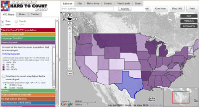
Baltimore Green Map

Baltimore Green Map has used the map making tool, Green Map, to map Baltimore's ecological and cultural resources. Over 250 green sites in the Baltimore region are featured on the map and it is possible to nominate other sites to be included on the map.

The map shows a number of positive citizen activities in Baltimore, such as community gardens planted, murals painted, parks’ partnerships activated, “green” schools, farmers markets, bicycle-friendly roadways; recycling centers and healthy eating venues.

Easton Urban Ecology Maps

Easton in Pennsylvania has created two green Google Maps mashups, an Urban Gardens and Urban Ecology Map and a Public Transportation and Biking Map.

The Urban Gardens and Urban Ecology Map displays community gardens, church gardens, select private gardens and other public gardens. Also included on this map are sites of interests in Easton such as restaurants, community centers, museums, and other attractions.

The Public Transportation and Biking Map identifies bike trails, pedestrian urban walking trails, greenways, parks, scenic views and by-ways, waterways, transportation facilities, and environmental amenities in Easton.

Green Brighton
Vegetarian and vegan restaurants, organic veg boxes, recycling centers, permaculture gardens and meditation classes in Brighton, UK.

_____________

Friday, January 29, 2010

Create Your Own Google Maps for Mobile

Mobile GeoRSS Maps

Map Channels has released Mobile GeoRSS. Mobile GeoRSS allows you to access your Google My Maps on a map optimised for mobile phone display.

You can use Mobile GeoRSS Maps to simply add a map to your mobile website, or to generate a map link for emailing. GeoRSS feeds and Google My Maps are supported by Mobile GeoRSS and Mobile GeoRSS maps work on any phone which supports the Google Maps v3 API, such as the iPhone and Android.

Creating a link for you mobile phone in Mobile GeoRSS only takes a matter of seconds. All you need to do is add a GeoRSS feed or the GeoRSS output from a Google My Map and Mobile GeoRSS will give you a link where you can access your map from your mobile phone.

GeoRSS Mobile even comes with a few customisation options. You can define the colour of the map markers, set the default map type and turn geolocation on or off.

_____________

Thursday, January 28, 2010

Google Maps Friday Fun

Google Street View Illustrations

Budapest-based designer Lehel Kovács has been busy creating an illustrated alphabet taking inspiration from Street Views. Cool Hunting have put together a collection of his illustrations.

Kentucky artist Bill Guffrey, whose Street View inspired painting have featured on Google Maps Mania before, has in turn inspired a number of sixth grade students. His blog now features a number of the students' paintings based on Google Maps Street View scenes.

The Stig Gets All Blurry

News of an Easter egg in last week's Street View update went around the Internet at least four times this week. If you spend hours searching the new Street View imagery around Loch Ness looking for monsters you may eventually find instead the above shot of the Stig.

For some reason, surely by mistake, Google have now pixellated the Stig. Boo!

Mr. Plimpton's Revenge

Dinty W. Moore has written an essay on Google Maps about the strange way that journalist George Plimpton keeps popping up in his life.

The essay uses Google Maps as an interface for each of Moore's encounters with Plimpton. It's well worth a read.

Tour of Vedbæk Strandvej

Microformats.dk has produced a Google Map Street View tour of Denmark's most expensive street, Vedbæk Strandvej. The tour is accompanied by a YouTube video of Abba singing 'Money, 'Money', Money'.

To view the tour load the route and press 'Drive'. The tour will will then automatically transport you along the street in Street View and update the location in the map view.

_____________

Immersive Tours with Google Maps

360Cities.net Immersive Tours Map

360Cites.net have released a new Google Maps interface to all of their 360 degree panoramic tours. It is possible to click on any of the markers on the 360Cities.net map and view the immersive panoramic tours directly on the map.

The map includes some interesting features to aid your navigation of 360Cities.net's stunning panoramic images. Many of the panoramas come with their own map overlays, which is particularly useful when navigating some of the indoor panoramas. The map sidebar updates as you pan the map to list all the panoramas in the current map view.

Each panorama also comes with a radar view which shows the current view in the panorama directly on the Google Map.

For some stunning views check out the Ten Beaches that Look Like Screensavers tours.

_____________

Google Map Tracking Boston Buses

MBTA.com T-Tracker Trial

The Massachusetts Bay Transportation Authority are currently trialling a Google Maps based live real-time bus tracking system for five bus routes. Using the trial map commuters can see the real-time locations of buses and obtain real-time arrival predictions for each bus-stop on a route.

Buses on the map are shown with numbered map markers that contain arrows indicating the direction of travel. Stops are shown as small red circles along the route. You can determine the name of a stop simply by moving the mouse over it and get arrival prediction by clicking the marker.

The trial seems to be being developed with the help of NextBus, who already provide real-time live bus tracking maps in San Francisco.

Other Train & Bus Tracking Maps
Flight Tracking Maps
  • GMaps Flight Tracker - inbound flight maps to some busy U.S. airports: Atlanta, Boston, JFK New York, Los Angeles and Chicago
  • North American flight tracker! - works for most commercial flights originating and arriving in the United States and/or Canada
  • Radar - tracking flights over Zurich
Boat Tracking Maps
_____________

Find NYC Parking with Google Maps

Roadify

Roadify is a free service that lets drivers tell each other about available street parking through text messaging or Twitter. The service is currently active in Brooklyn (focused on the area around New York Methodist Hospital) and has plans to cover the rest of NYC very soon.

The site is using Google Maps on its home page to indicate the number of parking spots that have been exchanged under the system. The map uses numbered map markers to indicate the number of times a particular parking spot has been passed on. The map is also useful as a guide to where the Roadify system is currently active.

Also See
_____________

Wednesday, January 27, 2010

Analysing the Content of Google Maps

Floatingsheep.org
I can't believe I haven't heard of this blog before but I'm delighted that it has finally come to my attention. Floatingsheep.org is dedicated to mapping and analysing user generated Google Map placemarks. The results of this analysis provides a fascinating insight into the socio-political make-up of places.

The blog has a series of interesting posts examining what Google Maps users are adding and where. For example this post compares the number of book stores and churches added to Google Maps across the USA.


The analysis finds that, for the most part, the relative prevalence of book stores occurs in and around the big cities and the eastern seaboard. Whereas suburban areas surrounding large population centres show a near-universal favouritism for churches.

Another great example is this look at User Created Geographies of Religion, which looks at religious references in user-created content on Google Maps around the world.

There are a number of other interesting analysis of user-created content on Google Maps. I strongly recommend you visit floatingsheep.org if you have a few hours to kill.

_____________

Google Maps Personal Suggestions


Google have added suggestions to the search box in Google Maps. If you are signed in with a Google account (and have web history enabled) when you use the search box in Google Maps you will now see suggestions based on your past searches.

The feature is very similar to the Google Maps Geocoding auto suggest experiment that I posted about this morning. However Google's implementation is not just restricted to place names. For example, if you search for cafes Google will use your search history to suggest cafes that you may have searched for before.

Via: Google LatLong

_____________

All California Parks on Google Maps

Park Info

Park Info is a Google Maps mashup displaying California parks, camp-grounds and trails.

The map displays data from the California Protected Areas Database and contains all California land whose use is primarily for open space and recreation and is fully open to the public. Park Info also uses Open Street Map's trails and paths layer to illustrate possible hiking and riding options in California.

It is possible to search the map for parks, camp-grounds and trails by address or zipcode. Results from each search are displayed in the map and in the map sidebar.

_____________

Google Maps Altitude Meter & Auto Suggest

Mapperz this week has spotted a couple of very interesting experiments with the Google Maps API.

Terrain Tile Layer

Bill Chadwick has put together this demo of a Google Map that has an altitude indicator to show the altitude at any point on the map.

As you move you mouse cursor around on the map the altitude indicator updates to show the altitude at each location. The demo uses a terrain tile server hosted on Google App Engine to serve tiles of terrain data. There is very good correspondence with the Google Maps Terrain layer contours which are obtained from the same 3 arc second SRTM data.

Google Geocoder Suggests

Esa, a Google Maps API guru from Finland, has put together this Google Maps API demo of a search box with geocoding suggestions. As you type into the search box possible locations, based on what you type, are displayed.

In the example above you can see the suggestions that appear when you type 'Lo'. The suggestions update the more you type. If you add an 'n' to the 'Lo' the suggestions change to reflect the added letter.

When you click on one of the suggestions the accompanying Google Map centres on the chosen location.


Via: Mapperz

_____________

Tuesday, January 26, 2010

A Childhood Walk with Street View

A Childhood Walk

ZeFrank.com has a really touching gallery of submissions he received from a recent project called 'A Childhood Walk'.

For the project Ze asked people to think of a walk that they used to make as a child. He then asked them to recreate the walk virtually using Google Maps Street View. Whilst on the walk, if a memory of a moment came to mind, he asked people to write it down and take a screenshot of the Street View.

The project is now over but the gallery of submissions is very cool and Ze kindly gives instructions on how you can create your own 'Childhood Walk'.

_____________

2010 Census Help with Google Maps

Census 2010 - Mapping the Hard to Count

The City University of New York (CUNY) has released an interactive mapping site to pinpoint census tracts that the U.S. Census Bureau considers difficult to enumerate, and display detailed demographic and housing characteristics that the Census Bureau believes will create challenges to achieving an accurate count in certain communities. The site allows census advocates to tailor their activities and address specific barriers, such as language difficulties or low educational attainment.

The site uses the Google Maps API for Flash and features interactive maps at the state, metro, county, and tract level, along with detailed statistics for each area. You can search the map in various ways, and also add overlays showing congressional districts, ZIP Codes, tract-level maps of 2000 census mail return rates, and recent foreclosure risk.

The site maps the "hard to count" population nationwide (based on the Census Bureau's analysis) to help local and national organizations target their outreach efforts for the 2010 Census and customize messages to communities at risk of being under counted.

Also See

Cynergy Systems Map - Google Maps based interface for viewing census data sets.

_____________

Google Maps Mashups from Data.gov.uk

The British government is currently being dragged kicking and screaming into the 21st century. Thanks to the advice of Sir Tim Berners-Lee, amongst many others, the government is finally opening up some public data to the public.

Data.gov.uk is a new website that gives some (still limited) access to UK government data. As well as providing access to the data the site is highlighting some of the applications that the public are building with the data.

As usual mapping applications are proving very popular. Here is a round-up of some of the Google Maps mashups being built with the newly released UK data:

Banjax

This Northern Ireland crime map is a heat map of criminal activity by ward from NISRA Statistics. Using a drop down menu it is possible to load heat maps for a number of different categories of crime, including robbery, fraud, theft etc.

One of the major problems with UK crime mapping is that the police only release data at a ward level. Hopefully, in the not too distant future, the now open UK government will start allowing the public to see the specific locations of individual crimes.

Safer Streets

Safer Streets is a pilot project to enable better communication between local authorities and the public. The project is currently trialling in three UK towns, Brighton & Hove, Luton and Solihull.

The public can use Safer Streets to tell their local council and police teams where they feel safe or unsafe and to view local safety information. The site uses Google Maps to allow the public to indicate the locations where they feel unsafe and highlight why.

FillThatHole.org.uk
This site provides a single site for reporting potholes and other road hazards across the whole UK. The site is funded by the CTC, the UK's national cyclists' organisation, as a service for UK cyclists.

Users are able to search for and view road hazards via a Google Maps interface.

UK Schools Map
The UK Schools Map is a Google Maps mashup that allows parents to find local schools. The site uses Ofsted scores and Edubase so that parents can find the schools with the best educational performance in their catchment areas.

Post Box Finder
This Google Maps mashup allows the public to search for nearby unlocated postboxes.

Users can look up postboxes nearby by entering the first half of a postcode. The site also includes postbox last collection times, if known.

ZubedJobs
ZubedJobs is a Google Maps mashup that lets you search for job by type and location.

_____________

Monday, January 25, 2010

NYC Safe Food on Google Maps

NYC BigMaps

NYC BigMaps have used the Your Mapper map creation tool to map restaurant inspections and 311 service calls in New York City.

The restaurant inspections map displays New York City Department of Health inspections across 5 boroughs since Jan 2008 (22,440 restaurants). You can search the map by category, date range, keyword, and location. The map then displays restaurants on the map at the location you searched.

Green map markers indicate restaurants with no health violations. You can click on any of the map markers to get details of any violations and to click through to the restaurant's page on the New York City Department of Health website.

The 311 Service Calls maps NYC SCOUT inspection reports of observed conditions to the 311 system since January 2008 (39,520 reports). Again you can search the map by category, date range, keyword and location.

Both the restaurant inspections map and the 311 service calls map are available from mobile phones.

_____________

Scribble Maps Goes Pro

Scribble Maps Pro

Scribble Maps, the Google Maps mashup that lets you draw directly on a Google Map, has now released a 'pro' version that has elevated the application into one of the best Google Maps creation tools.

In the past Scribble Maps allowed you to draw directly onto Google Maps and add coloured polygons. You could then save your scribblings and polygons and even export a kml or jpg or gpx file. The new pro version of scribble maps still allows you to do this but also has a host of new features.

One of the exciting new features in Pro is the ability to upload data in the form of spreadsheets. This allows you to plot points on Scribble Maps. You can even plot points within a specified range in your spreadsheet.

Other new features include the ability to add SHP files, the option to use OpenStreetMap and CloudMadePlus maps and the option to add measuring tools. As with the original Scribble Maps you can publish a finished map to your own website or blog in the form of a widget.

________________

A Virtual Protest on Google Maps

Taksim

In Turkey a number of websites, such as YouTube, are banned. To protest this web censorship Taksim are organising a virtual protest via Google Maps.

The site uses an embedded Google My Map, which anyone can add themselves to by using the 'edit' button. Users are encouraged to add themselves at Taksim Square in Istanbul. When the protesters achieve the target number, the plan is to walk to Parliament House in Ankara, pixel by pixel.

Via: Read Write Web

________________

Sunday, January 24, 2010

Mapping the Great Indoors

Micello

Google Maps can show you the location of your nearest Ikea. It can even give you driving directions from your front door to the Ikea parking lot. What it can't do is give you the floor plan of Ikea. That's where Micello comes in.

Micello is an iPhone application that allows you to search on Google Maps for nearby stores and then lets you view a map of the inside. Micello is busy mapping the inside of shopping malls, convention centres, retail stores, airports, college campuses, and more.

Currently Micello maps around 250 inside spaces, mainly in the San Francisco area but has plans to have over 5,000 locations by the end of 2010.

Micello iPhone app (App Store Link)

________________

Black Collar Crimes on Google Maps

Black Collar Crime Blotter

This Google My Map shows crimes committed by people affiliated with religious institutions as compiled by The Freedom From Religion Foundation.

The map uses different map markers for those 'arrested', 'convicted', 'sentenced' and 'civil lawsuits'. Clicking on a map marker will reveal details of the crime committed and the source of the story.

________________

Bathymetry Data on Google Maps

Bathymetry Map for Sacramento-San Joaquin Delta

This rather beautiful looking Google Maps mashup shows bathymetry data for the Sacramento-San Joaquin Delta. The map uses a colour scale to show the depth of the delta on the map.

It is possible to add a map overlay from the National Oceanic and Atmospheric Administration. The map also has a feature to draw a line across a section of the map and view an elevation chart for that section.

Via: Mapperz

________________

Saturday, January 23, 2010

Local Knowledge on Google Maps

Askaro

Askaro has a pretty healthy pedigree. It is the new project from Eduardo Manchónwho, co-founder of Panoramio. Askaro is a hyperlocal site, that Manchónwho has set up with Ubaldo Huerta, to try and help people find out more about their neighbourhoods.

The site lets users exchange information where it matters the most, in our neighbourhoods and places of work etc. Users can ask a question in a specific area by placing the question on a Google Map, so that people who live or know the area can give an unbiased and helpful answer.

Askaro combines geolocation, and question and answer reputations, as the basis of its inner workings. Questions are asked, or placed, in a specific area of a city, in order to reach out to the people who live or know the area. Askaro give the analogy of placing a flyer at your local grocery store to reach out to locals.

Answers can be voted as "Good" or "Bad" by anyone, which has the effect of moving them up or down. The question's author can also designate a specific answer as the "Best answer". Best answers turn green and move to the top.

The number of votes and the answers marked as "best answer" are used to calculate the reputation score, which becomes a measure of how valuable each respondent's contributions and answers are. The users with the best reputation in a city can be found in the "Local Heroes" page.

________________

More Cities get Aerial View

Google has unveiled more Aerial View imagery. Portland, OR, Sacramento and Oakland, CA all now have Google's version of 'bird's eye' imagery.

The new imagery gives much closer zoom levels and allows the map user to view buildings and streets from four different directions. Orbitz, Redfin and Trulia have already updated their websites to include the new imagery.

Orbitz is now displaying this imagery for their Sacramento hotels. Redfin is showing an "Angled" view of their properties in Oakland. Trulia is presenting a "Perspective" view for properties in Sacramento. Toggle to the "Perspective" view from the map for each listing.

If you are interested in using aerial view in you own maps take a look at the concepts, reference and examples of the Google Maps API documentation. Or have a look at the code of some of the demos I've put together myself:

Via: Google Geo Developers Blog

________________

Friday, January 22, 2010

Visit Sweden Adds Street View

Visit Sweden

Visit Sweden, Sweden's official website for tourism and travel information, has been using Google Maps for many years to help visitors to the country discover the many interesting places to visit. This week's release of Street View imagery for the country means that Visit Sweden can now also provide Street View imagery on their maps.

Visit Sweden has created Google Maps for each of Sweden's main regions. The maps each have a number of layers that can be viewed. The layers include Culture, Family vacation, Nature experiences, Outdoor activities, Gastronomy, Coastline experiences, Wellness, Design and Airports.

Now, when a point of interest has a Street View image available, a 'Street View' button appears in the top right of the information window. Clicking on the button will display the Street View inside the information window.

________________

The Immigrant Story on Google Maps

Immigrant Connect Chicago

Immigrant Connect Chicago is an online network for immigrants, their families and communities. The website tells the personal stories emerging from the immigrant communities in and around Chicago.

The immigrant experience is historically one of isolation and insecurity. The Immigrant Connect Chicago project therefore brings together storytellers with those with stories to share. The project connects college and high school students eager to learn more about diverse cultures with people eager to have their stories told.

On the home page of Immigrant Connect Chicago is a Google Map that acts as an immigrant story locator. Immigrant stories from around the world are displayed on the map. Clicking on any of the map markers will load the collected immigrant stories from countries around the world.

________________

Thursday, January 21, 2010

A Red Light Street View Tour

San Diego Zoo Tour

I've updated my San Diego Seaworld Street View tour to include imagery from San Diego Zoo, which was added to Google Maps yesterday.

Now, as well as viewing dolphins in Street View, you can see some elephants, giraffes and rhino. Google Maps Bird's Eye imagery is available in San Diego. So as well as the Street Views my tour includes oblique aerial view imagery of San Diego Seaworld and San Diego Zoo.

Istedgade Street View Tour


Microformats.dk has put together a Street View tour of Istedgade, Copenhagen. Istedgade is a red-light street in Copenhagen. However it also has a more heroic past. The citizens of this area began the resistance to German occupation during World War Two.

The title of the map "Istedgade overgiver sig aldrig" means "Istedgade never surrender", a phrase used by Copenhagen's resistance movement. The tour uses Google Maps' driving directions so all you have to do is press the button to load the route and press 'drive'.

The tour is accompanied by a YouTube video of Danish singer Peter Belli. I'm informed that the song is about a girl who works as dancer in a bar and tells the story of the men who fight over her.

________________

Street View Tour of Copenhagen

Kongens Nytorv - København

Using the new Street View imagery for Copenhagen microformats.dk has created a really cool tour of Copenhagen. The mashup synchronises the Google Earth browser plugin with Street View to show you 360 degree panoramas in both Street View and Google Earth.

The tour works particularly well because of the extensive 3D buildings available in Google Earth for Copenhagen. To view a location just click on the Google Map. The tour then zooms in on that location in the Google Earth plugin and automatically rotates around the view. A Street View embed also rotates giving you the same view but as seen from the ground.

________________

Wednesday, January 20, 2010

National Trust Street View - Updated

NT Street View Map

Today Google have unveiled some stunning new Street View imagery of National Trust houses and castles in the UK. This Google Map mashup allows you to view the new Street View imagery.

To view the Street View for one of the National Trust properties just click on the property's name in the menu and then click on the blue Street View layer on the map. The Street View will appear under the map.

I was only able to put this map together so quickly because, by chance, last week Mapperz was kind enough to share with me a list of lat/longs for UK National Trust properties.

SV Mapplets
SV Mapplets have also produced a mapplet for Google Maps that shows all the National Trust properties with Street View. The Mapplet allows you to select any of the National Trust Properties and view the Street View directly within Google Maps.

________________

Community Mapping with Google Maps

HabitMap

HabitatMap was started in 2006 in Brooklyn to document the links between the built environment of New York City neighborhoods and the health and well being of the people who live, work, and play in these neighborhoods. Now the site is open to participants and contributions from around the globe.

HabitMap is a community mapping and social networking website. Getting involved is easy. Simply identify something in your neighborhood that either enhances your quality of life, such as a local farmers market or public park, or is cause for concern, such as a historic building threatened by bulldozers or a contaminated property down the block, and add it to a Google Map.

You can also create your own Google Map highlighting a specific area of interest, embed maps on your website or blog, invite fellow activists to contribute to your maps, and discuss issues and recruit collaborators in the HabitMap forums.

Here are some links to some of HabitMap's featured New York neighborhood Maps,
________________

Street View Comes to Sweden and Denmark

Thanks to a heads up from Street View Gallery (who heard a rumour Street View was to be released tomorrow in Sweden) I have just noticed that Street View imagery is already live in Sweden and Denmark.

As well as Sweden and Denmark there seems to be more Street View imagery added to countries already covered. For example in the UK it seems that many National Trust properties now have Street View. Check out Stowe House, Nymans Gardens, Glendurgan Garden, Castle Drogo and Corfe Castle.


Corfe Castle


Storkyrkan, Stockholm


Nyhavn, Denmark


Frederiks Kirke, Copenhagen


Københavns Kommune


Oresund Bridge


Riddarhuset, Stockholm


Turning Torso, Malmo

________________

Post Photos & Video on the Go

Pegshot

Pegshot is an iPhone application that lets you share videos and photos of places. With the Pegshot app you can share a video clip or photo captured on your iPhone via a link on Twitter or Facebook.

When your friends click on the link, they are taken to a web page with a Google Map and the video or photo.You can upload shots to Pegshot on 'the go' or later with WiFi.

iPhone app (iTunes store link)

________________

A Javascript Library for Google Maps

Cartographer.js
Cartographer.js, is a simple javascript library for Google Maps that allows map makers to easily create thematic heat maps, area-scaled circles, and pie charts. Using the library developers are freed from worrying about how to tweak the Google Maps API to build the thematic elements they need, and can focus on more important problems like data collection and normalization.

Cartographer.js is a simple one-line include. The library comes with a number of demonstration maps showcasing what Cartographer.js can do:

Where is Twitter?

Where is Twitter? is a Google Maps mashup of 250,000 Twitter users that uses area-scaled circles to show the number of Twitter users in different locations around the world. Clicking on any of the displayed circles reveals the number of Twitter users at that location.

State Populations

This Google Maps mashup displays data from the US Census: 2008 state population estimates, rendered on a choropleth (heat map) map.

________________

MapAction in Action in Haiti

MapAction
In times of national disasters aid agencies are often affected by the lack of accurate up-to-date maps. This is particularly true after massive earthquakes, such as the one that hit Haiti last week, when many roads have been damaged and have become unusable.

MapAction tries to meet the need for vital information in the form of maps, created from information gathered at disaster scenes. MapAction is a non-governmental organisation (NGO) with a substantial track record in field mapping for disaster emergencies. Since 2004 they have helped in 20 emergencies including the Asian tsunami, floods and tropical storms and now in Haiti.

One day after the Haiti earthquake MapAction deployed a four member team to the country. MapAction's Chief Executive Nigel Woof says: "Within days we expect that dozens - or probably hundreds - of aid organisations will be trying to make sense of the shattered landscape and communities in Haiti. Our job is to gather information that can be mapped to create a shared operational picture, so that people most in need get the right types of help".

Their maps have been crucial during the search and rescue phase on the ground. They are now creating a shared operational picture for relief deliveries. WFS and KML feeds have been created displaying Urban Search And Rescue (USAR) sectors for Port-au-Prince and 1:50 000 topographic maps for Haiti.

MapAction is a registered charity and you can support their efforts by donating here.

Google Maps for Haiti
Anyone who is involved in building Haiti Google Maps mashups can get the freshest content for Haiti by enabling Map Maker data in the API.

The following Google Map Maker map types are available:

* G_MAPMAKER_NORMAL_MAP displays the standard road map view
* G_MAPMAKER_HYBRID_MAP displays a mixture of normal and satellite imagery.

You can read more about the Google Map Maker Types in the Google Maps API Developer Guide.

Haiti Earthquake Before and After Imagery

Mibazaar has put together this Google Map that displays some of the latest post earthquake GeoEye satellite imagery of Haiti. The imagery helps to convey the sheer scale of the destruction caused by the earthquake.

________________

Tuesday, January 19, 2010

Create a SatNav Tour with Google Maps

MapMe.ie

MapMe.ie is a SatNav tour generator that can help you plan a travel itinerary in Ireland. MapMe.ie allows you to select tourist destinations from all over Ireland and download them to your SatNav for free.

Using a Google Maps interface users can search for destinations. It is possible to search the map by category from a drop down menu. The categories include historical, cultural and food and drink. It is also possible to search for locations by clicking on the map.

Click once on the map and an information window will open allowing you to search for local points of information by a specified distance around the selected location. You can then click on any of the displayed destinations and add them to your SatCart.

________________

Make Your Own Google Weather Map

Global Temperature and Five Day Forecasts
Popular map creation site UMapper have unveiled two great new features that allow you to add weather temperatures and five day forecasts for anywhere in the world to your created maps.

It is extremely easy to create a weather map with UMapper in just two simple steps. This video tutorial explains how it is done:


In addition to the new weather features you can add custom icons, audio overlays, images and much more to your UMapper created Google Map.

________________

Google Map of US Drone Attacks

U.S. Drone Attacks in Pakistan

This My Map shows the approximate locations of all U.S. drone attacks in Pakistan since 2004 on Google Maps. Strikes prior to 2008 are shown with yellow map markers, those in 2008 during the Bush administration are shown with red markers, and strikes during the Obama administration are green.

Most strikes are on Pashtun villages in North and South Waziristan in the Federally Administered Tribal Areas along the Afghan border. Clicking on a map marker opens an information window with details of casualties and a link to a source for news of each drone attack.

________________

Popular Posts