Blog Archive

Showing posts with label iPad. Show all posts

Wednesday, March 7, 2012

iPhoto for iOS Map via Google Maps


A lot of people have noticed that the new iPhoto for iOS does not use Google Maps. Some people are even wondering if this is the first sighting of Apple's long rumoured replacement for Google Maps in the Maps app of iOS.

Refnum Software have managed to import the new Apple Map tiles into the Google Maps API. Their map, Apple Map Tiles, allows you to view the new Apple Map using the Google Maps interface.

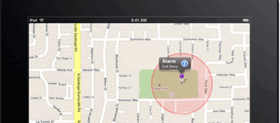
Having a look at the iPhoto map I doubt that this version will end up replacing the Google Maps in the Maps app for iOS. First off I don't think it is aesthetically pleasing enough. Secondly at the moment the map tiles aren't detailed enough to be a full replacement for Google Maps (although it is possible that Apple are holding back on a few zoom levels for the iPhoto map).

You can bet that Apple Maps is coming but it looks like Apple still have some work to do before they replace the Google Maps app in iOS.

Tuesday, November 15, 2011

Stuck on Earth? What a Nice Place to Be


Flickr maps are probably one of the most overdone types of Google Maps mashup. Therefore I very rarely post them on Google Maps Mania any more. Stuck on Earth, however, is a thing of great beauty and deserves an honourable mention.

Stuck on You is an iPad travel guide application. The app itself works on the simple premise that most users of travel guides mostly look at the photographs and think 'I want to go there". The app therefore allows the user to explore the world through beautiful photography.

Stuck On Earth uses photography shared on Flickr. You can follow individual photographers that you like via the app and you can even submit your own photographs. Whilst browsing the app you can create individual trips based on your favourite locations and all saved trips can be accessed even when offline.

Via: TNW

Wednesday, July 13, 2011

Local Bay News on Google Maps


The California Newspapers Partnership has released an iPad app that uses Google Maps to present local news for the Bay Area in California. The app presents coupons, events, restaurant and other business listings, and feature stories, photos and video on a Google Map of the Bay Area.

The application includes three main modes. 'On tap' presents the day's local news and local deals. 'Explore' uses Google Maps to present local events. The third mode, 'Find,' allows users to search the application for news, deals and other features.

The app is currently free but there are plans to charge a monthly subscription fee in the future.

TapIn (iTunes link)

________________

Friday, May 27, 2011

Google Maps Plus for the iPhone & iPad

Maps+

Maps+ is an iPhone and iPad Google Maps application from IZE that improves on the default iOS maps app with a few new useful features.

Maps+ lets you record and edit GPS tracks. With a tap of a button you can start recording your location. When you are finished recording you can edit the track by deleting individual waypoints or by trimming the beginning or the end of the track.

Maps+ also allows you to set location based alarms. You can set an alarm at a location, for example for a specific train station when you are on a train, and get a reminder when you reach that location.

The application also acts as a Twitter client. You can use this option to view Tweets around your current location live on a Google Map.

_________________

Popular Posts