Blog Archive
-
▼
2006
(522)
-
▼
July
(39)
- Google Maps sites to share and explore the world!
- Greenpeace France GE Google Maps Censored by Frenc...
- Cambodia's first Google Maps Mashup
- Google Maps Miami Vice Movie Mashup
- Google Maps for Mobile now includes a traffic mashup
- Airplane pollution and Airport Parking Google Maps...
- Mashup of North American, Japanese baseball stadiums
- Google Maps mashup for the Middle East Conflict
- Google Map of Botched Police Raids
- New US Google Maps mashups for summer
- 10 Google Maps Mashups with worldwide reach
- Google Maps Sights and Vids
- More ways the news and media are using Google Maps
- Google Maps in context
- Google Maps API: Speed improvements, custom cursor...
- Google Map of Israel Lebanon Conflict (using KML)
- New Google Maps US Zip Code Mashups and Tools
- Google Maps + 10 Fastfood Chains = Fast Food Maps
- UK Google Maps Mashup Roundup Part 2/2
- Google Maps Mashosphere Trend: "Book Maps"
- UK Google Maps Mashup Roundup Part 1/2
- Overheard in New York + Google Maps = Overplot
- 4 new US Real Estate Google Maps Mashups
- 3 new US Weather & Earth Google Maps Mashups
- Superb Golfing Google Maps Mashup: GolfBonk
- Google news map of the Mumbai Bomb Blasts
- New zoom feature for Google Maps (and API)
- Google Maps Package Tracker App Roundup
- Google Maps in context
- 9 new US Google Maps Mashups: Ice Cream, Movies, C...
- Google Maps sparks real estate mashup boom in Spai...
- YouTube + Google Maps = Virtual Video Map
- Virtual Online Shopping with Google Maps Mashups
- Mapping Your Photos with Google Maps
- Google Maps Mania in China
- New Canadian Google Maps Mashups
- 2 new Google Maps Mashups for Australia
- Tour De France Google Maps Live Tracker
- Google Maps Creation Tools and Resources - Part 7
-
▼
July
(39)
Monday, July 31, 2006
Google Maps sites to share and explore the world!
Sunday, July 30, 2006
Greenpeace France GE Google Maps Censored by French Court
 Greenpeace France has been ordered to remove a Google Map from its website revealing the locations of genetically modified cornfields -- information which the EU apparently requires the government of France to make public. Greenpeace France complied with, but will likely appeal, the censorship order. They also carved a giant crop circle X into one of the fields, making its location visible from the air.
Greenpeace International is now hosting the map from its servers in Amsterdam:
http://www.greenpeace.org/censored-map
Read more here..
Saturday, July 29, 2006
Cambodia's first Google Maps Mashup
 +
+ 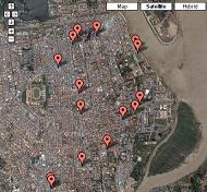 Before the recent satellite imagery update to Google Maps several countries were limited from creating maps mashups due to low resolution imagery and no street maps. This situation is changing with this last update and Cambodia is one of those countries that is now visible for the mashing!
Phil Lees writes to Google Maps Mania saying "With the recent update to various Google Maps across Southeast Asia, Phnom Penh in Cambodia has changed from an unrecognizable blob to an actual city. In response, I've started Cambodia's first mashup: "Mapping Phnom Penh's food" -- From what I can see, this mashup is much more than just food and drink for one of the world's most interesting cities, it also includes many other Cambodia places. There is a Cambodian Beer Map, and a street food map and other categories (see "::map" in the list) of food and drink choices around Cambodia. The cool part is that each of these map pins links to a blog post from Phnomenon.com that gives great info.
This is a useful mashup for those backpackers and tourists visiting Phnom Penh. Based on the limited choices for maps-based Cambodian travel info, this is a great resource for everyone visiting this country!
Related Google Maps resources for Cambodia:
Wikimapia: Angkor Wat (amazing new imagery) and Cambodia
Tagzania: Cambodia tags
Flickr Images: Cambodia
Technorati blog posts: Cambodia
Wednesday, July 26, 2006
Google Maps Miami Vice Movie Mashup
 +
+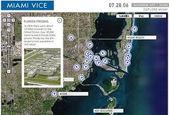 Upcoming Hollywood movie Miami Vice has made use of the Google Maps API to let film goers experience the culture, crime and history of the city that the movie is set in. It's a great mashup with unique info windows and a very cool "auto-zoom" feature that can be toggled to bring you to the map pin location automatically upon clicking. [via]
Related:
Internet Movie Database: Miami Vice (2006)
Check out more Movie mashups here
Google Maps for Mobile now includes a traffic mashup
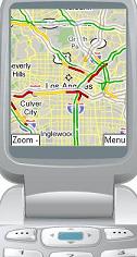 The Google Blog informs us recently that its Google Maps for Mobile
product now includes a feature that lets you map real-time traffic in various parts of the US from your mobile phone. From the Google Maps for Mobile site: "See where the congestion is, and estimate delays in over 30 major US metropolitan areas." On the maps red shows congestion, yellow or orange shows moderately busy traffic patterns, and green means there are no present traffic situations. In this latest feature release Google is making a traffic maps mashup part of the standard product offering for mobile mapping.
Google Maps for Mobile lets you search Google Maps street and satellite maps for directions and business search from your mobile device. To try it out point your phone or mobile device to: www.google.com/gmm to install it instantly, or if you just want to try the app out from here on the web, there is an awesome interactive demo that gives you a test drive from your web browser. Full details on supported devices and other info can also be found here. I personally use this on my Blackberry and I love it. I've used it on a number of occasions when trying to find roads or to locate businesses near where I work and it works very well.
Tuesday, July 25, 2006
Airplane pollution and Airport Parking Google Maps Mashups
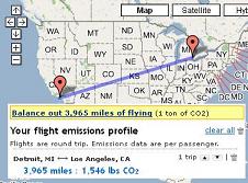 See how much CO2 your next flight puts into the air - This Google Maps tool calculates the amount of CO2 a flight from any two points puts out, per passenger. I ran a quick search for Detroit to LAX and my CO2 emissions would be 1,546 lbs! Your flight gets plotted on a Google Map while the tool tells you how you're polluting. :) [Via ProgrammbleWeb]
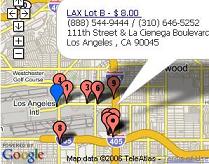 Find Airport Parking near all US Airports - Before you board that flight and contribute those thousands of pounds of CO2, you need to find a place to park the other object that pollutes your environment.. your car. (oh, and save some money too!). If time permits, instead of using the main airport lot, look for a place to park using About Airport Parking (.com). In addition to providing links to security and general airport delay status, it Google Maps the locations of lots in the area near the Airport you're visiting. Here is an example for LAX. A great idea for a mashup!
Mashup of North American, Japanese baseball stadiums
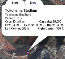 It's summertime in the northern hemisphere and that means baseball.. and lots of it. World Ballpark Tour uses Google Maps to plot the locations of all of the baseball stadiums in the US and Canada from the major leagues to the AA level of the minors. It also includes locations for Japanese stadiums. Tabbed info windows give interesting facts and information for each stadium. This accompanying article will help you to learn other "baseball type stuff" you can find using Google Maps.
Google Maps mashup for the Middle East Conflict
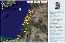 In an attempt to help those affected by the conflict in the Middle East, Koolyoom.com has emerged as a Google Maps mashup (of other mashups) to help war victims. It features a Frappr Map that allows you to "localize yourself for your family and friends", a news panel with war related news feeding in, and a Google Map of significant points within the region. This map of points could be significantly improved by adding some descriptions to the info-windows and perhaps link to a Google News search result page for that point. The site also links off to the Maps view of the KML file (see "Conflict Map") I posted about a while back. This KML file should definitely be opened up in Google Earth rather than Google Maps since only the first 100 points show up when viewing it using Maps.
...Once again Google Maps is a vital web ingredient to help in yet another aide situation.
Monday, July 24, 2006
Google Map of Botched Police Raids
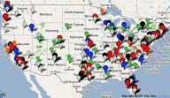
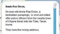
In another example of Google Maps aiding in journalism (or spotlighting an issue), The Cato Institute has made use of Google Maps to illustrate the issue of botched police raids. The map plots deaths and raids of innocent people, injuries and deaths of police officers, nonviolent offenders and also unnecessary raids on doctors and sick people. Filter data by state, years (as far back as 1985) and types of incidents. There is some good background detail and tips for using the map.
[Via Laurence Timms]
New US Google Maps mashups for summer
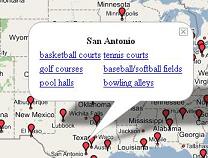 Find a Pick-up Game with this mashup - PickUpGame (.com) is a Google Maps based tool to find basketball courts, tennis courts, softball/baseball fields, golf courses, pool halls & bowling alleys in your city. The purpose of the map is to help you easily find these places for easy pick-up games. With 31 cities live more are being added daily.
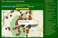
Adirondacks Mountain Region: Birding Sites Map - If you're near the Adirondacks region this summer you'll want to check out this superb bird watching mashup to find the featured areas of a lot of different types of birds. Amenities such as Visitor Centers are also mapped. To view the Google Map integration click "Search By Map". Google Maps API enthusiasts will want to just check out the great design work that has gone into this mashup.
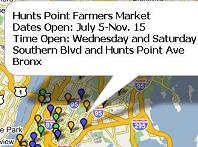 New York City Farmers Markets - The New York City Coalition Against Hunger has used Google Maps to plot the locations of all NYC farmers' markets. Markets are also color-coded to show which accept food stamps as well as all free summer feeding sites for kids, color-coded depending on who operates them. Check out more of the Coalition's Google Maps that are helping the cause on the groups' website.
Park Reviews - Google Mapping various state parks
Garage Sale Maps - Share your yard sale or cruise for more
Golf Courses - Browse US golf courses
Reedy Creek Greenway - A greenbelt in North Carolina [via]
Sunday, July 23, 2006
10 Google Maps Mashups with worldwide reach
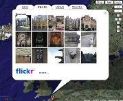 GeoWalk mashes up wikis, photos, news and more - Here's a cool mashup that combines Wikipedia, Flickr and Google News with any point on a Google Map that you click on. That's right, double click anywhere on the Google Map and GeoWalk will provide you with the closest Wikipedia entry to that location, tagged Flickr photos and news as well travel and weather for some locations. This mashup is also available in German language. [Via ProgrammableWeb.com]
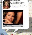 Askmen.com poll results on Google Maps - Created by Virender Ajmani, this is a mashup of polling statistics from AskMen.com that lists the top 99 women from around the world, according to the site visitors. Those in the top 25 also contain a video from YouTube.com. Sort through the list using the buttons found along the top of the map.
Other worldwide Google Maps mashups:
- SalaryMap geo plots sample salaries
- Renewable Energy projects from around the world [via]
- World Map of elongated souvenir pennies [via]
- International Gay Guide & Business Directory
- World Skateboard Locations [via]
- Record Store Globetrotter
- Google Maps Kayak and Canoe Wiki Guide
- Wundergound.com includes Google Maps for personal weather stations
Saturday, July 22, 2006
Google Maps Sights and Vids
Google Maps Sights: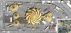 Cirque Du Soleil Tents in Vancouver [via]
Sinking ship off the shores of Kuwait [Via Digg]
Swastika shaped building [via]
Too close for comfort? - Virender Ajmani annotates the locations of 5 aircraft taking off from Atlanta's airport noting how close each one is to the other as they take off... or are they all the same plane? (Close the info window to move to the next plane)
Madurodam Miniature City in the Netherlands
Where's Jesus? Can you see it? (Luistxo from Tagzania)
Rockefeller Center is about to collapse!
New "Collections" site: http://www.satelliteviews.net/
..Check out the "Collections" links for more Google Maps satellite imagery finds!
Google Maps Videos:
"The guy behind Google Maps" -->
(If the clip is not displaying, click here)
"Google Earth - Has it gone too far?" -->
[Via Earth-Maps]
(If the clip is not displaying, click here)
More Google Maps videos: YouTube, Google Video
Friday, July 21, 2006
More ways the news and media are using Google Maps
Frugal Traveler on the Road
The New York Times Travel has created "Frugal Traveler on the Road" which uses Google Maps to help you follow the journey of a travel writer setting out to "hopscotch the globe using low-cost carriers, buses, trains, ferries and your travel tips."
Showing the path of a prison escapee
The Sydney Morning Herald's Stephen Hutcheon has used the new DIY site QuikMaps to show readers of the article "Sydney prison escapee rams police" what path the convict took after breaking out. Why don't more news organizations do this sort of thing?
Road Trip 2006
"C|Net News.com packs the gadgets and hits the highway" - This Google Maps mashup tracks roving reporter Daniel Terdiman as he makes use of gadgets and chronicles tech along the west coast of the US. Lots of great articles, videos and photos.
Did you get a chance to read my series on How Google Maps is used in News & Media? If not, check it out:
How Google Maps is used in News & Media - Part 1
How Google Maps is used in News & Media - Part 2
Google Maps in context
Boston Globe - Jul.20/06
Mashup Camp 2: A Tie for Best Mashup
ProgrammableWeb - Jul.17/06
Levels of the Game: The Hierarchy of Web 2.0 Applications
O'Reilly Radar - Jul.17/06
Visionary Markets with Mashup
Arkansas Business Journal - Jul.17/06
First DIY Google Maps site Mapbuilder.net turns 1
Mapbuilder Blog - Jul.13/06
Google erases Malta
The Register - Jul.12/06
Google Maps' and Google Earth's looks diverge
OgleEarth - Jul.11/06
Details about SnowWeb Australia July 28-30
Snow Web - Jul.11/06
Vietnam Wikimapia
Noodlepie - Jul.11/06
Google Maps Saves The Day
Lockergnome - Jul.10/06
Google's strategy: no need for instant marketshare, yet
BloggingStocks - Jul.10/06
Go forth and API
Vitamin - Jul.2/06
Google Maps API: Speed improvements, custom cursors & geocoder updates
Jess Lee, Product Manager of Google Maps, has just posted about some changes to the Google Maps API over on the Google Maps API Blog. Highlights include:
- Significant speed improvements in removeOverlay() and clearOverlays()
- Custom mouse cursors
- Accuracy in the geocoder response
- Simple geocoder response
Other API Resources: Google Maps API Docs, Google Maps API Group
Thursday, July 20, 2006
Google Map of Israel Lebanon Conflict (using KML)
UPDATE: Due to the large number of placemarks, not all locations are visible in Maps making this look like a biased map - To view all locations for this map be sure to open it up in Google Earth.
New Google Maps US Zip Code Mashups and Tools
Map helps you see neighoring zip codes - Maps.Huge.Info has long had a great list of Google Maps based boundary and zip code tools. Geo Developer John Coryat has informed me that he has improved his zip code map to use a custom tile layer which covers the US from zoom level 5 to 17 with potentially millions of tiles. When you search a zip code you see all other zip codes close by - give it a try!
Other US Zip Code Google Maps Mashups & Tools:
- Local News, Traffic, Weather (and more) by zip code (Good)
- eBay Search Tool by zip code
- Zip Code Map - All US zip codes
- Classified ads by zip code
- Froogle Search (enter zip code)
- Movies by zip code
- 100 Mile Diet - Eat food within 100 miles of your zip code
- Indie Bookshops by zip
- Mapping Election Donors
- Berkeley Crime by zip code
- Places to play Poker by zip code
- Theme Parks by zip code
- Warranty Service Centers by Zip Code
- Hospital pricing by zip code
Wednesday, July 19, 2006
Google Maps + 10 Fastfood Chains = Fast Food Maps
If FastFoodMaps was only a large size mashup before, it has definitely been super-sized with the most recent update! Its creator Ian Spiro dropped me a line to let me know about some of the improvements he has made:
- Pizza Hut, Taco Bell, KFC, Carl's Jr., Hardee's, and In-N-Out and has been added to the listings of McDonald's, Wendy's, Burger King or Jack in the Box locations
- Somewhat more accurate geocoding of locations
- The interface provides statistics about the current screen / zoom level
- You can turn off layers of data.
- Animated map pins that bounce! :) (This is the first I've seen this on any mashup)
Just over 50,000!
The reason I think this mashup is unique is that the geo-plotted data means something different for everyone visiting. For some it will be a way to locate their favorite fast food chain on a Google Map, while for others, the littering of pins on the map will put them in disgust due the number of available fast food chains dotting the US landscape. No matter how you look at it, it's a powerful mashup and interesting topic (along with some great Google Maps API work!).
..Would you like fries with your mashup? :)
Think this story is cool? Digg it!
Tuesday, July 18, 2006
UK Google Maps Mashup Roundup Part 2/2
UK Local Knowledge Directory.. Mapped! - KnowCal.co.uk has created a way to interact with its local business directory on a Google Maps interface. Create an instant mashup up all locations of all Nightclubs, Nurseries or Nail Technicians by selecting the alphabetical list or sort through sub categorized ethnic restaurants, Shopping or Tourist activities. This is a true database mashup!
Monopoly Pub Crawl
UK Classifieds + Google Maps
EventSites - UK Web 2.0 site employing Google Maps
UK Climbing Experiences [via]
UK GeoJobs [via]
Old London Town - Crime/History Map
Other Great UK Google Maps Mashups:
Traffic & Transportation: London Tube Journey Planner, GTraffic, PetrolPrices, BBCTraffic News, Traffic Incidents, Speed Cameras
Real Estate: Nestoria, Zoomf, OnOneMap, UK Property Search
Shopping/Eats: SuperHighStreet, eBay UK Search Tool, UK BiteFinder
UK Info: 5 day UK Weather, UK MegaMash, Library Map UK, Mapping UK schools to postcodes, UK School Map, Pubs of London
Places: London UK Places Google Sightseeing, Interesting Satellite Locations, Panoramic Images of London, UK Dr. Who Taping Locations, TV Map UK
Sport/Leisure: Professional UK Football Grounds, BBC UK Sport Map, UK Motorsport Venues, Nike Run London Route Finder UK, UK Local Walking Routes, UK Orienteering
Check out Part 1 of the UK Google Maps Mashup Roundup!
Google Maps Mashosphere Trend: "Book Maps"
Littourati Blog - Blog description: "Literature often describes places we are curious about, regardless of whether we know them or not. This blog maps the journeys laid out in selected books and offers reflections corresponding to the various stops. Happy traveling!" This is facilitated by this Google Map (and the Littourati Blog)
Data Mining 101: Finding Subversives with Amazon Wishlists - This blog post maps publicly accessible Amazon Wishlists to plot readers of various controversial titles. It's a very thought-provoking post.
Library Maps:
Find a Library in the US and Canada
UK Library Map
San Francisco Library Map
Chicago Library Map
An Illinois Library system Google Maps routes
((Do you Digg it?))
Monday, July 17, 2006
UK Google Maps Mashup Roundup Part 1/2
Other UK Google Maps Mashups:
Green Brighton - vegetarian and vegan restaurants, organic veg boxes, recycling centers, permaculture gardens and meditation classes.
UK Handbag Theft Map - (Only works on Internet Explorer)
Crawl Planner
UK Speed Cams
Tap Water Quality for fish tanks
UK Knickers Map - More info here
Exeter College Campus
Mapperz - An excellent maps blog that covers many UK-based Google Maps sites as they are launched
Check out Part 2 of the UK Google Maps Mashup Roundup!
Overheard in New York + Google Maps = Overplot
For more New York City Google Maps mashups check here!
Popular Posts
-
Here again is another (the 11th) roundup of the latest Google Maps Creation (and Viewing) Tools and Resources. I've assemble these list...
-
+ = Google Maps Mashup Roundup Part 1 (of 2) ( See Part 2 here.. ) Google Maps is powering the Web 2.0 craze here in Canada . It is bringi...
-
Boston.com has used the previously mentioned Atlas Google Maps tool to create a map of the recent Mooninite scare in Boston . You might re...
-
Massachusetts contributions to gubernatorial candidates - Faneuil Media dropped by to tell me about a very interesting and eye-opening Goog...
-
Sacramento Crime Tracker - This next mashup is a great example of how media can use Google Maps to display information for those in the com...