
The Nader / Gonzalez Road Trip Map is a Google Maps mash-up showing the locations of the team's supporters as they travel around America gathering signatures to get on each state's ballots.
Supporters in the field are using cellphone SMS and Twitter to update signature counts and location. The signature/location is then fed onto a Google Map. Users of the map can click on any of the tags to check the number of signatures collected in that state.
Back at the beginning of June Google released its Elections '08 Map Gallery. At that point the gallery featured five map mash-ups; Primary Results, Fundrace, Twitter, Obama's Journey, McCain's Journey
Since then another seven maps have been added to the gallery.
Search Queries
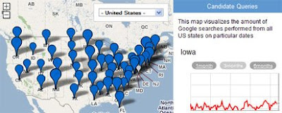
This map visualises the amount of Google searches performed from all US states on particular dates for a particular candidate.
Campaign Trail
The Campaign Trail Map tracks the candidates as they make their way around the country.
Superdelegates
This map tracks which candidate each of the superdelegates has endorsed for President. Superdelegates get to cast a vote for the nominee at the 2008 Convention, and are not obligated to vote for the candidate who won their state.
Obama Videos
Videos of Obama's campaign speeches and media appearances are tagged on this map. Videos will be updated throughout the election year.
McCain Videos
Videos of John McCains' campaign speeches and media appearances are tagged on this map. Videos will be updated throughout the election year.
Electoral Votes
This map allows you to predict the election result by experimenting with different possible election results. You do this by clicking on a state to change the vote for that state. You can also load past election results onto the map.
US Senators
The US Senators map allows you to click on any state to get details of the two senators for that state.
_____________


0 comments:
Post a Comment