As promised yesterday, here is the second part in our look at location based web applications. This two part post was inspired by Peter Batty's presentation at the GeoWeb conference last week so it seems only fair to start with his own project whereyougonnabe.
whereyougonnabe
Whereyougonnabe is a Facebook application that helps you meet your friends more often. You tell whereyougonnabe where and when you will be doing things in the future and can see when your friends will be close to you.
It is a great tool for keeping up with what your friends are doing. You can view your location and your friends' locations on Google Maps or Google Earth. Here's a video with Peter explaining the service himself,
Dopplr
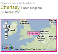
Dopplr is one of the better known future location services. Dopplr lets you share your future travel plans with your friends and colleagues. The service then highlights coincidence, for example, telling you that three people you know will be in Paris when you will be there too.
You can use Dopplr on your computer or your mobile phone and it links with on-line calendars and social networks so it easy to update your future locations.
Plazes
Plazes was recently acquired by mobile phone company Nokia. Like the other future location services Plazes allows you to plot where you will be and see who will be crossing your path and what will be happening nearby.
One really nice feature of Plazes is Radar, which lets you explore an area on a Google Map and discover who is currently in that location and what places people have recommended.
TripIt
TripIt is a personal travel assistant that automatically organizes all your travel plans.
To build a travel itinerary you simply forward your travel confirmation emails to TripIt. TripIt then automatically combines your related travel bookings into a single master itinerary and searches the web for related information, including daily weather, Google Maps, driving directions, city guides and much more.
You are able to share your complete itinerary with friends or family who need to know your travel plans, or collaborate with fellow travellers on a trip. You can also create a network of TripIt Connections so you can view friend's travel calendars and get alerted when your travel plans overlap with each other.
Placely
Placely also lets you plan a travel itinerary. Once you have entered a planned trip Placely will give you a page with maps from Google, a five-day weather forecast and content from Yelp.com.
With Placely it is easy to share your itinerary with friends and colleagues and see if their travel plans overlap with yours. On a Google Map you can see how close your friends are to your location and you can synchronize schedules with your friends.
________________
Blog Archive
-
▼
2008
(604)
-
▼
July
(56)
- Getting Where You Need To Go
- More Sites Add Google Maps Street View
- Free Our Data
- Population Summary Map
- Where Are You Going To Be?
- Google Maps Gets A New User Interface
- Where Are My Friends Now?
- Safe Roads on Google Maps
- Create Embeddale Flash Google Maps
- Embed a Street View
- The Latest YouTube Videos on Google Maps
- Some Friday Google Maps Fun
- Two Ways to Build Google Maps Mash-Ups
- Google Maps Walks the Long Way Around
- Tracking Bluetooth Devices on Google Maps
- Live Video on Google Maps
- Animated Weather on Google Maps
- Google Maps Walking Directions
- All the Criminals Near You on a Google Map
- Ride Sharing on Google Maps
- Boat Race Tracking on Google Maps
- Planning a Gap Year on Google Maps
- CitySearch for iPhone
- Google Map Showing Starbucks Closures
- Google Maps Gearing Up for the Olympics
- Something for the Weekend
- It's Friday - It's Google Maps Fun
- Change the Background of Your Map!
- TV Trips on Google Maps
- Spanish Google Maps Mash-Up Round-Up
- Arizona Game and Fishing Google Maps
- More Election Fever on Google Maps
- Ten Useful Google Maps Gadgets & Widgets
- Album Covers on Google Maps
- YouTube Adds Google Maps
- Google Trends Live Mapping
- Some Google Maps Friday Fun
- Webcams on Google Maps
- Google Sightseeing Goes Multilingual
- ArcGIS API for Google Maps
- Real-Time Ship Tracking on Google Maps
- Lively Google Map
- More Crime on Google Maps
- Satellite Coverage Map
- Viewing 3D Buildings in Google Maps
- Horse Racing on Google Maps
- Follow the Tour De France in Street View
- Some Friday Fun From Google Maps
- Twitter Weather Map
- The Tour de France on Google Maps
- Street View Now in France
- The Fourth of July on Google Maps
- Germany Google Maps Mashup Roundup
- Mapdango Adds Google Friends Connect
- Amazing Google Maps Mania Timeline
- Map of 37,000 Skeletons in London
-
▼
July
(56)
Tuesday, July 29, 2008
Subscribe to:
Post Comments (Atom)
Popular Posts
-
Here again is another (the 11th) roundup of the latest Google Maps Creation (and Viewing) Tools and Resources. I've assemble these list...
-
+ = Google Maps Mashup Roundup Part 1 (of 2) ( See Part 2 here.. ) Google Maps is powering the Web 2.0 craze here in Canada . It is bringi...
-
Boston.com has used the previously mentioned Atlas Google Maps tool to create a map of the recent Mooninite scare in Boston . You might re...
-
Massachusetts contributions to gubernatorial candidates - Faneuil Media dropped by to tell me about a very interesting and eye-opening Goog...
-
Sacramento Crime Tracker - This next mashup is a great example of how media can use Google Maps to display information for those in the com...
0 comments:
Post a Comment