
Katrina People Map helps people get rescued - This Google Maps mashup can be used as an aid (not a primary means) to provide information about people stranded in the Gulf Coast of Katrina affected areas. The website states:
This is for information only and "hints", **do not use for any critical situation**. Information may go out of date quickly. This site is not affiliated with any organization or service -- just trying to help.
The mashup directs you to contact groups such as the Coast Guard, Louisiana Homeland Security and the Red Cross FIRST, then provide information on this map to assist in the effort. (Note: Scroll to the bottom of this page to see the map-mashup) [via]

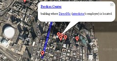
"Interdictor: Survival of New Orleans Blog" uses Google Map - The Interdictor blog has been a popular source of information for news media like CNN throughout the past week. There are webcams, blog entries, interviews and minute-by-minute accounts of the things taking place in New Orleans by a group of individuals that have been in a downtown office tower since before the hurricane and resulting levee break occurred. Check out the blog, then use this Google Map to understand more about the exact locations which are mentioned in the numerous blog posts and links.
NOTE: The map location for KatrinaShelter.com has been updated. You can view it here.

Do you know of any other Hurricane Katrina related Google Maps sites? If so, please post a comment to this post so I can bring Google Maps Mania readers up to date!
Technorati Tags: [katrina], [hurricanekatrina], [googlemaps], [New Orleans]


0 comments:
Post a Comment